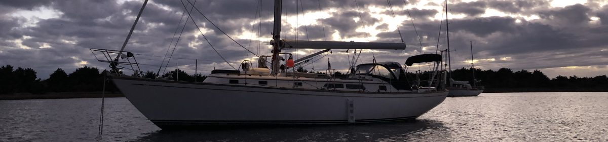
Andante rode out yet another gale, this time in Galesville on the West River. Lots of rain and wind didn’t bother her a bit. And the down day gave me time to change the oil and filter and transmission fluid. And do some laundry. Good times.
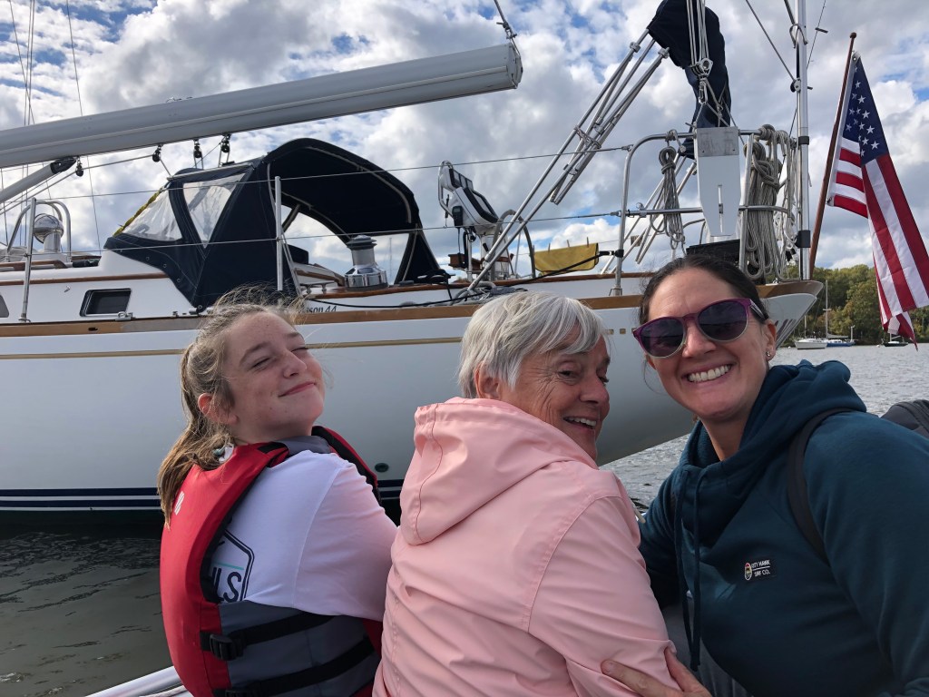
The following day was extra nice. Not only was it sunny and a bit warmer but my mom and sister and niece all visited Andante for the first time. I reconstituted Dinghy for the day to ferry people and the groceries that my sister brought (yay!). It was definitely a physical challenge for my mom but she did great. And it was actually a good thing we were on a mooring as the docks at the marina were underwater.
Mom found some creative and athletic new ways to get in and out of Dinghy. And she completely rocked the steep ladders f0r getting aboard and below on Andante. Good job mom!
After spending some time together aboard we all went out to lunch and ate oysters and mussels and rockfish and squid and a giant soft pretzel covered with crab dip. Not a bad day at all.
We enjoyed both the view and the food at Stan & Joes Riverside in Galesville. Glassy calm after the storm. I took advantage of the conditions to wash Andante’s topsides and remove all the nasty brown scum that has been accumulating.That’s a little better. Mom did great climbing up the little fender-ladder that we use for transferring people from Dinghy to Andante.
From Chesapeake City we travelled the last few miles of the C&D canal and then south into the Chesapeake Bay and the Sassafras River on Maryland’s eastern shore. We found a nice anchorage in a river bend protected from the strong northeast and northwest winds, set out almost 250 feet of chain, and hunkered down for a big blow. The Coast Guard was repeating gale warnings on the VHF every 20 minutes or so and advising small boats to take shelter. When it blew, it blew hard for about 36 hours with wind exceeding 42 kts. Andante rode it out well while I read a book, reorganized some lockers and drank a lot of coffee.
Editorial note: While I can write and sort photos anywhere, the software I’m using for this blog (WordPress) requires an internet connection to actually construct and publish the posts. The Sassafras River is remote with limited cell service and it wasn’t possible to upload photos and such. There will be days like that. Thanks for your patience.
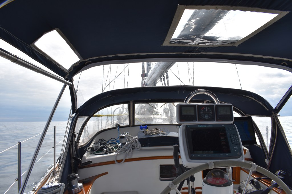
We anchored as close to shore behind these hills as we could to get some protection from the wind. The water was pretty shallow outside the main river channel so we couldn’t get as close as I’d hoped.Adjacent to our anchorage was a fish weir. This is a contraption made of sticks and nets formed into a maze that traps fish. It was marked with flashing yellow lights at night. This was a bit disconcerting as with this much wind I was on high alert for any evidence we were dragging our anchor. And its hard to judge distances at night from a flashing light.Andante’s anchoring setup. We carry almost 300′ of 3/8″ BBB chain. Once the proper scope of chain is deployed for the water depth (3:1 for lunch, 5:1 for a nice sheltered anchorage, 10:1 or more for a storm like this) I attach a nylon snubber line with a rolling hitch and let out another 20-30 feet. The snubber acts as a shock absorber which makes a choppy anchorage more comfortable and reduces shock loading on the anchor. The almost-ancient Maxwell-Nilsson windlass is used to retrieve the anchor chain. Deployment is by manual free-fall. The folding handles on top of the windlass control a friction brake (like the drag on a fishing reel) to allow a slow and controlled deployment.After the storm passed the wind really died and we enjoyed a nice quiet sunset. Quiet except for the crazy honking of hundreds of Canada Geese heading south. The boat in the photo is “The Nors” a catamaran we conversed with by radio during our trip through the shoals off of Cape May. They told me their plan was to follow us (and our 6.5′ draft) through the shoals knowing that then they’d be just fine. Glad to be of service. There is no reason for this picture to be here. Just a cool angle I guess. I have been wondering if I need to tweak the starboard lowers just a little. Can’t tell if that’s really a slight bend at the lower spreaders or an optical illusion.
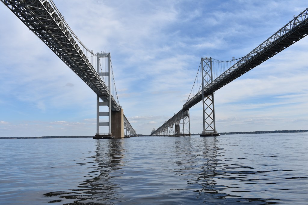
From the Sassafras we continued south Thursday towards the Bay Bridges and Annapolis. Yet another big storm was anticipated for Friday. We made good time and passed under the bridges shortly after noon.
The two spans connecting Maryland’s western and eastern shores just north of Annapolis. The only other bridge across the bay is the Chesapeake Bay Bridge-Tunnel 130 miles to the south in Norfolk/Hampton Roads where the Chesapeake opens to the Atlantic.
Although I had been looking forward to spending an evening in Annapolis I was NOT looking forward to being forced to sail in strong winds and driving rain the next day. We’re expecting some family to visit us at a marina about two hours south on Saturday. Getting stuck in Annapolis was not really an option. So we pressed on for another few hours to the little town of Galesville on the West River – where my parents had kept our family’s boats for many years when I lived in the area.
Thomas Point Light near the mouth of the South River is probably the most photographed object in the Chesapeake Bay. We passed close enough to get a few nice pictures of our own.We fueled and watered before heading to our mooring. Hoping to head out again early Sunday when fuel docks will be closed.
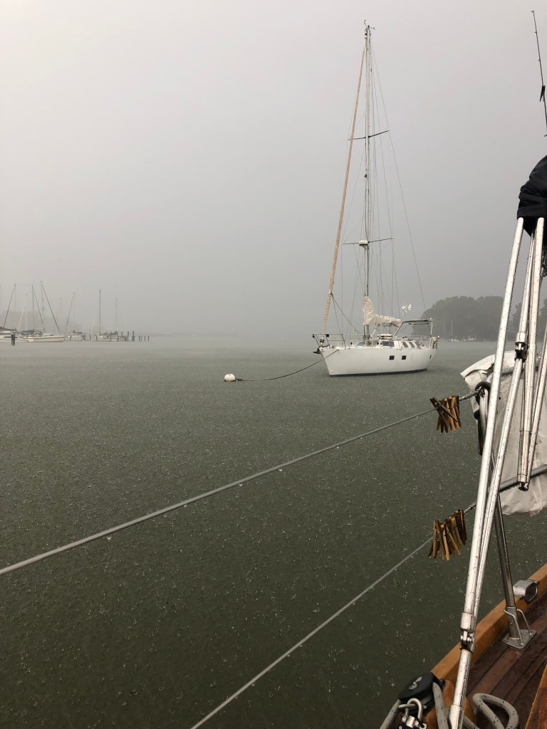
We had just secured ourselves on our mooring when the wind started to pick up. Thursday night it was windy and a little rainy. Its now Friday evening as I’m writing this and its still blowing 25-35 kts and raining extremely hard. And last I checked the docks at the marina were all underwater — glad I opted for a mooring. Since there was nothing to be done outside I spent today changing the engine oil, oil filter and transmission fluid. Its easiest to do these sorts of jobs at a location (like this marina) that accepts waste oil. And has a laundry facility for afterwards. I guess that’s a job for tomorrow morning.
While the winds were not gale force this time, we got some good hard rain in Galesville on the West River
Radar suggests the rain will taper off soon and the forecast is for pleasant conditions tomorrow for family visits. While the laundry is sloshing I’ll give the boat a quick clean to make it presentable for guests. At least I don’t need to worry about rinsing the salt off the deck…
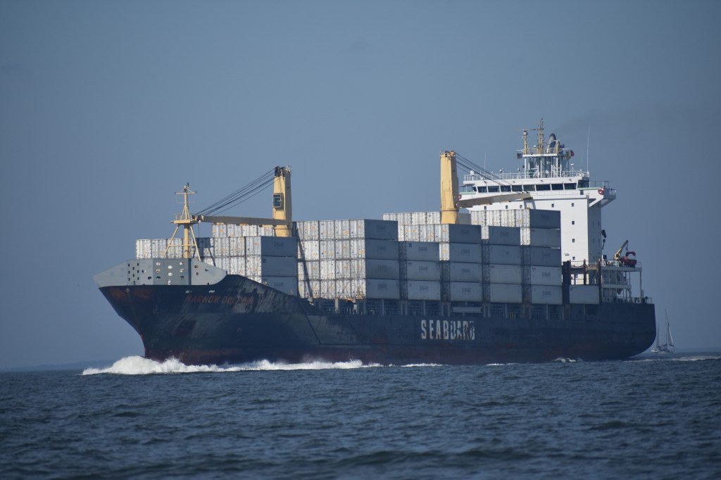
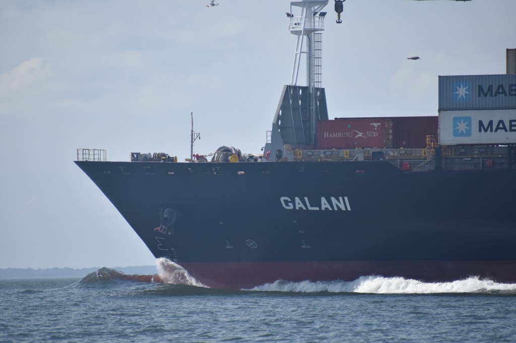
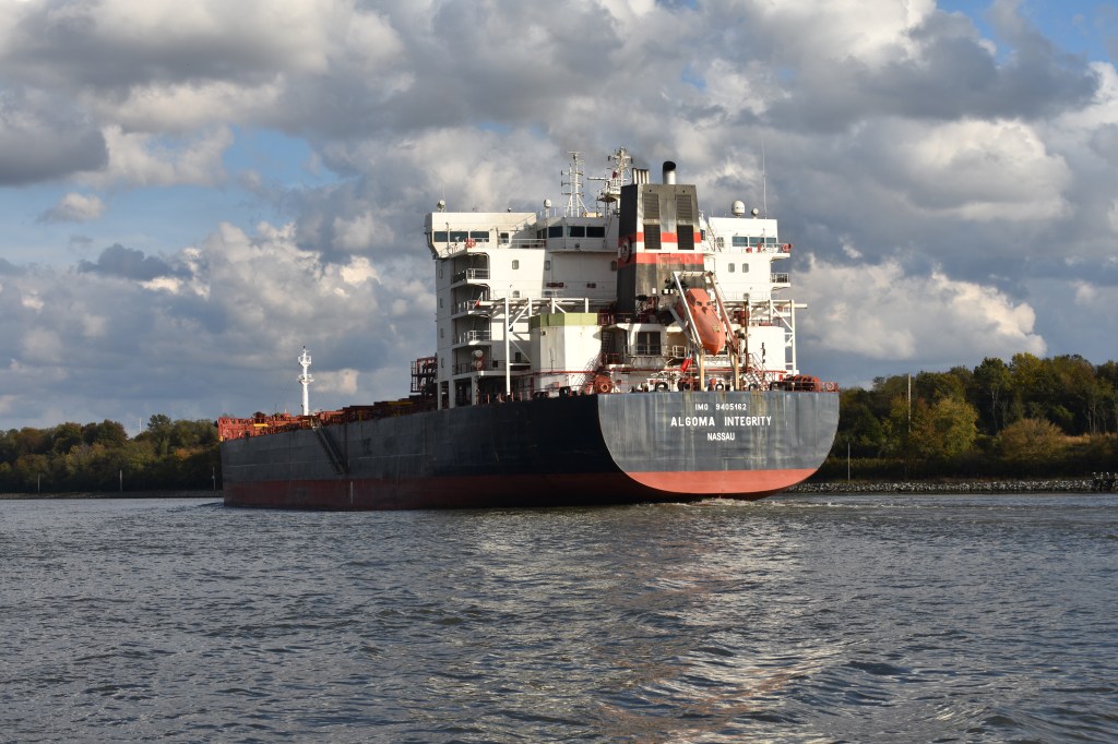
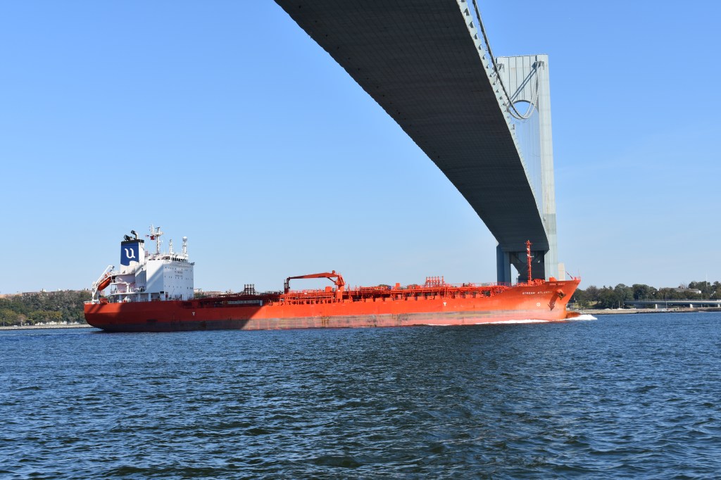
There is a large amount of commercial ship and barge traffic on the Delaware Bay and River, the Chesapeake Bay, and the Chesapeake & Delaware Canal that connect them. On this leg we passed mostly natural, barren shorelines that make you wonder what all these ships are up to. But if you zoom out a bit you quickly see the critical connection that these waterways provide between major East Coast ports including New York, Wilmington, Philadelphia, Baltimore, Washington and Norfolk — and all the small towns and power plants in between that require regular deliveries of oil. The big ships are generally constrained to a narrow channel we try to avoid. In the narrow C&D Canal AIS, radar and slow speeds prevent surprises around the next bend.
The leg from Cape May up Delaware Bay and through the C&D Canal was relatively tame weather-wise. We had some headwinds and seas on the initial departure from Cape May as we had to head southwest around Prissy Wicks Shoal. Andante is a bit too big for the shortcut backdoor Cape May canal. Once we threaded our way through the shoals and started up the bay the winds were generally light. We timed the tides just right and enjoyed as much as a 2 kt push on the trip north.
Motoring with the yankee up for a little extra push. We enjoyed speeds exceeding 9 knots due to the strong favorable current.
The banks of the Delaware Bay are pretty spartan. Marshes, a few trees, the occasional nuclear power plant. But there is life, especially birds.
I did not notice any 3-eyed birds.Bald eagle on Red 8, just offshore of Eagle Island. Coincidence?
The C&D canal is about 20 miles long and connects the Delaware River (just below the big Delaware Memorial Bridge on I-95) with the upper reaches of the Chesapeake Bay. In many ways this canal is similar to the Cape Cod Canal. Both were expanded from existing small waterways and both are run by the US Army Corp of Engineers. Even some of the bridge architecture is vaguely similar. While the Cape Cod Canal railroad bridge is far more attractive and ornate, the Contrail bridge over the C&D is more active with freight train traffic all day long.
Entering the C&D from the Delaware River.Conrail railroad bridge on C&D Canal.The canal is deep right up to the riprap on shore. Which is good because I pulled way over to the side for this guy.
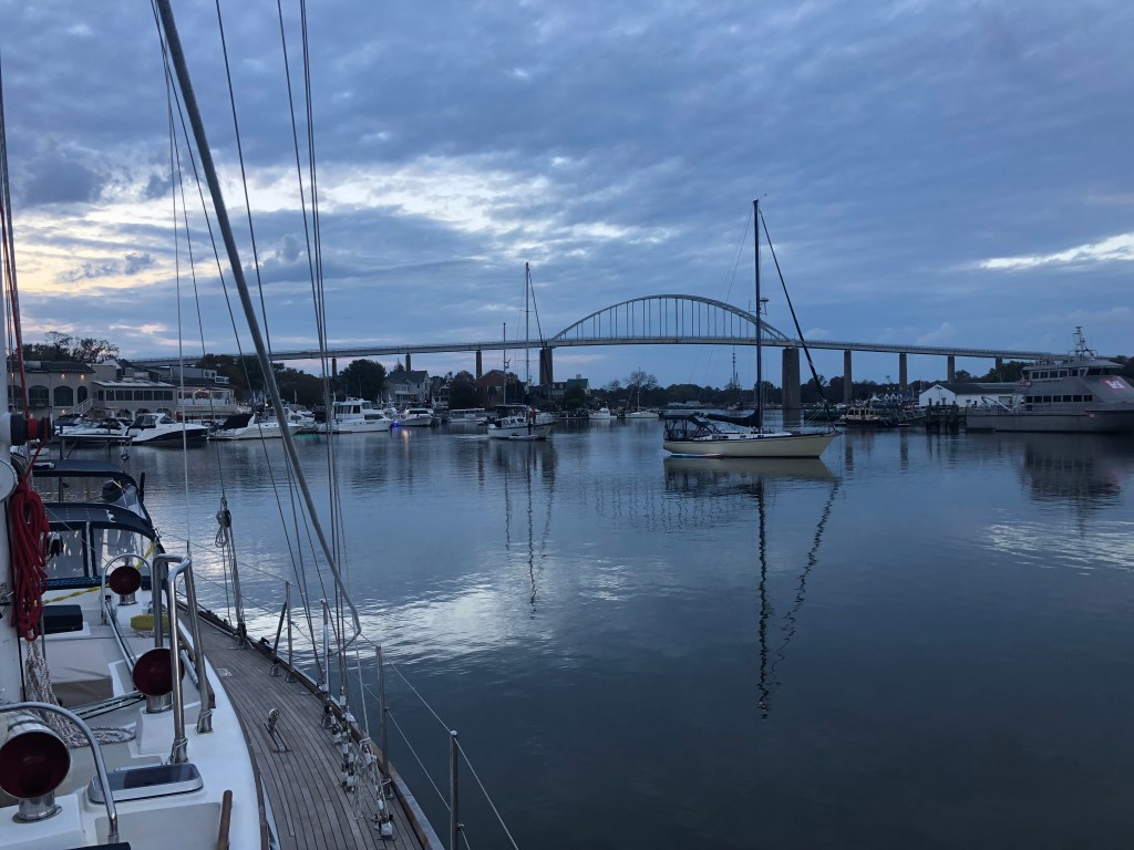
With severe storms rolling in we stopped for the day at Chesapeake City. Its a cute little harbor about 2/3 of the way along the canal with restaurants and bars and crabs. But the anchorage was small and crowded and I had no plans to go ashore. When the thunderstorms hit later that evening two boats (both unoccupied at the time – owners were at the bar) dragged through the soft mud and ended up pinned against the beach and docks on shore. Both boats and crews were fine afterwards. We decided to leave as soon as possible the next morning to find a more secure location to ride out the multi-day gale that was forecast to arrive in the afternoon.
Only short-in-stature, challenged-in-draft vessels can navigate the intracoastal waterway protected by the Jersey Shore’s barrier islands. Unlike the ICW south from Norfolk, VA the New Jersey segment is very shallow and the fixed bridges that cross it are shorter than the 65 ft standard. So real boats need to head out into the Atlantic at Sandy Hook and sail offshore to Cape May, a distance of about 120 nm. There are a few inlets in between that can be used to break up the trip (notably Atlantic City) — but we chose to press on and get it done in one 24-hour period.
Friday afternoon we filled the fuel tank, refilled the snack locker, and gave the engine a thorough checkup. On Saturday morning we left the Atlantic Highlands boat basin at dawn. It took more than two hours to navigate north around Sandy Hook, into the Atlantic, and then back south along the beach to the latitude of our starting point. There were lots (LOTS) of little fishing boats for the first few hours. I didn’t see anyone actually catch anything, but from the volume and diversity of boats (and the salty language on the radio) you could tell these folks were serious about their sport.
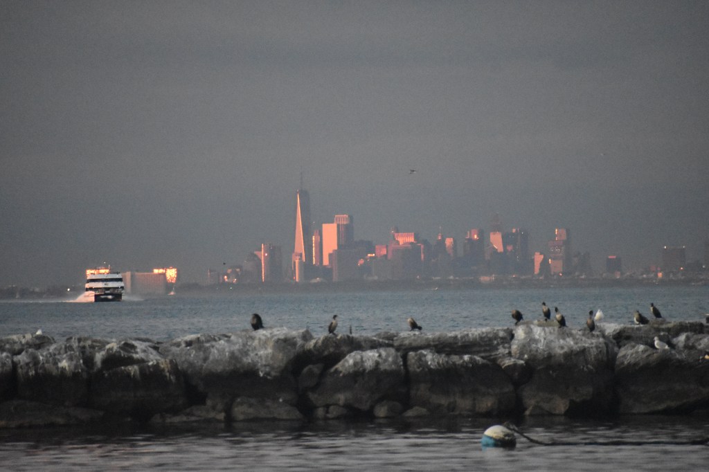
The Atlantic Highlands boat basin has an amazing view of downtown Manhattan.After much messing about in inland bays and sounds it was a good to finally be out in the ocean and heading in the right direction.
Weather conditions were generally good with a few clouds and a light drizzle in the morning. A few scattered showers were predicted for the evening. It was cool enough and with enough rain potential that I put up the bimini to provide a windbreak and keep the cockpit somewhat dry. And I bundled up too.
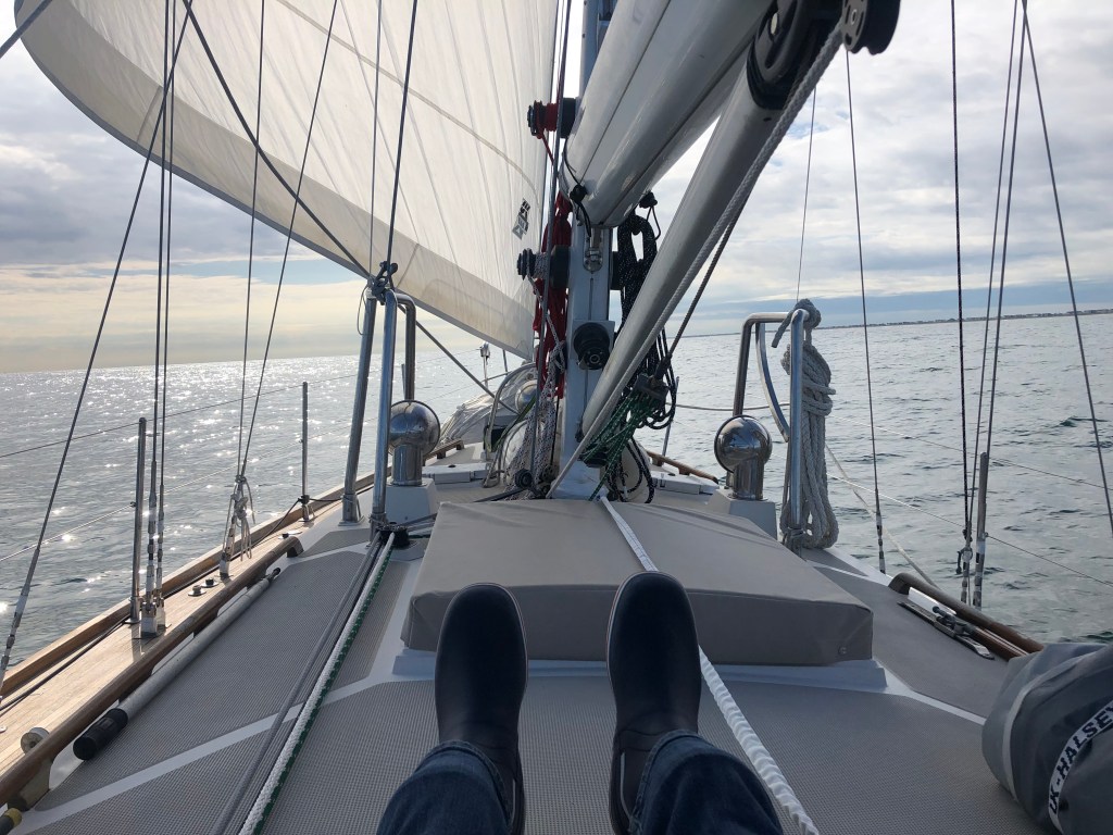
Winds were light and from behind. On a flat sea we probably could have sailed the whole way but with a 2-3 foot quartering swell we were rolling and the sails were not effective on their own. So the engine ran for the first half of the trip to keep us moving at a reasonable pace. The genoa did help stabilize the boat as long as there was enough wind to keep it full. To escape the noise and smell I spent time forward of the cockpit as conditions allowed.
An almost glassy Atlantic
The Jersey shore is not particularly photogenic from 1-2 miles offshore. In some areas there were lots of little cottages and families at the beach, in others the entire beachfront looked commercial. Each of the towns was different, none more so than Atlantic City. The high-rise buildings were visible from more than 20 miles away in daylight and the gaudy lights further still after dark.
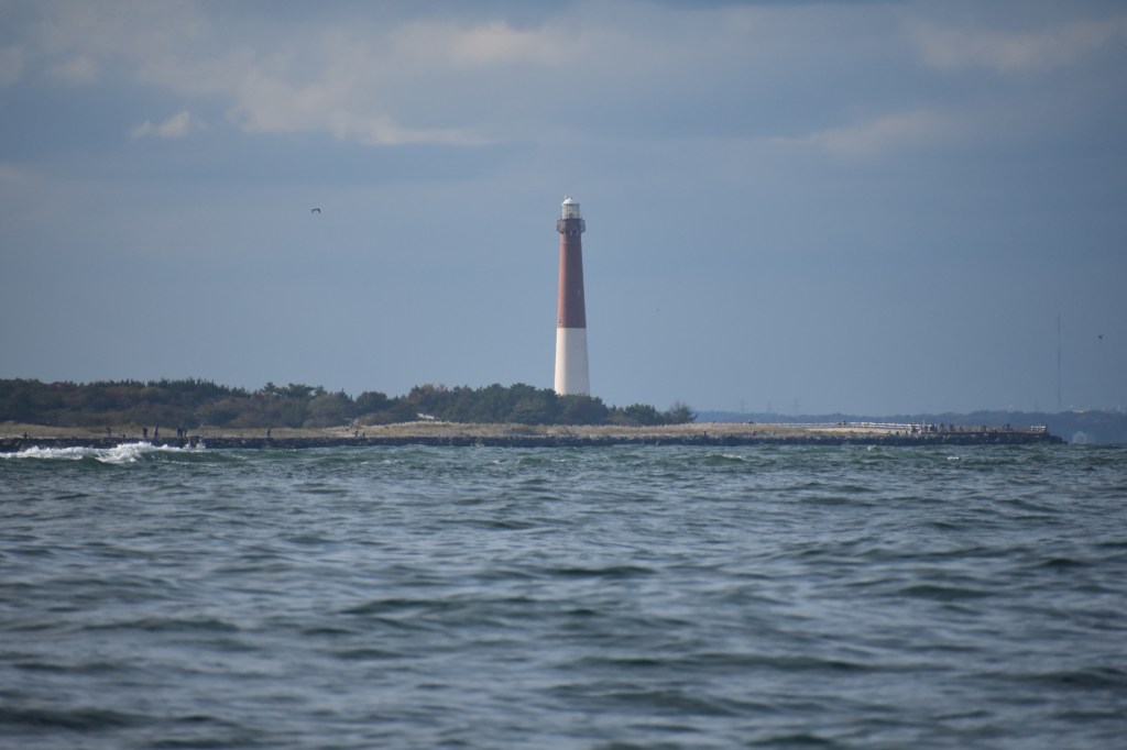
Barnegat Inlet is known for its occasionally rough and dangerous conditions. The wreckage of a sailboat was being cleared as we sailed past. The Barnegat Lighthouse is one of the taller and more attractive along the coast.
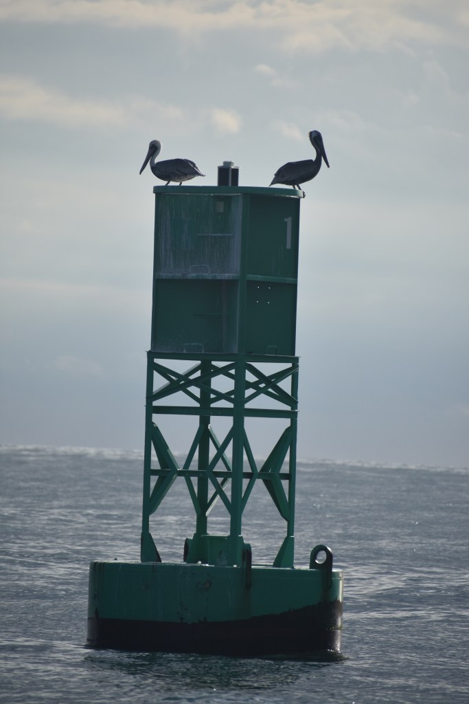
With the glassy conditions I was disappointed to see no whales. But I was ecstatic to see some brown pelicans. These are generally warm-climate birds that migrate to the mid-Atlantic states in summer and are very rarely seen as far north as Cape Cod. More evidence that we are making significant progress southward.
Pelicans!
An afternoon rain shower provided some interesting colors. The full rainbow was visible but I was unable to get a photo of the complete arch as my camera lens wasn’t wide enough.
Rainshower and colorful aftermath
Right around sunset the wind picked up as a few more small storms passed over us This let us shut down the engine and sail for the second half of the trip. It was glorious cruising along at 7 kts on a starry, moonlit night.
Storm comingMoonlight
Cape May is a well-protected harbor with an easy-to-navigate inlet. Which is good, because I had to navigate it at 0400 this morning after 22 hours of sailing. Fortunately there was still some moonlight. And also GPS. And radar. And a very effective range. And lighted channel markers. And I had studied other accounts of finding the anchorage in the dark. So using just those few tools we found a nice spot to anchor just off the beach adjacent to the Coast Guard training facility. And then went to bed.
We are literally a stones throw from the beach. We’re well-protected from the weather. Not so protected from the fisherfolk who started zooming by before 6 this morning.Coast Guard training facility in Cape May
From Cape May the fundamental routing decision is whether to continue south on the outside to Norfolk, or head inshore up the Delaware Bay, across the C&D Canal, and down the Chesapeake Bay to Norfolk. I’m looking forward to having some family visit us in the Annapolis area — so we’ll be taking the inshore route this time.
Today, besides napping, I’m working on planning our transit of Delaware Bay and the C&D canal. It looks like the weather should be passable tomorrow – not perfect, but workable – and the all-important tides and currents align nicely with daylight hours. The leg from Cape May to Chesapeake City (near the Maryland end of the C&D canal) is about 75 nm but should take less than 10 hours if we can ride a favorable tide the whole way. A substantial gale is expected Tuesday and Wednesday. If all goes according to plan we’ll ride that out in Chesapeake City. From there its on to Annapolis, then down the Chesapeake to Norfolk to join the ICW.
After a very peaceful night in City Island we enjoyed an absolutely gorgeous day today on the East River and New York Harbor. Its hard to imagine better weather conditions for this leg in late October: Sunny, clear, and warm. And we timed the tides just right so that the passage down the East River and through Hell Gate was a non-event and we were pushed through the Narrows at more than 8 kts. Vessel traffic wasn’t nearly as bad as I expected. There were plenty of large ships and tugs and barges and ferries and jet skis (really) but it wasn’t the total mayhem I expected.
As a result I was able to take a ton of photos. I’ll share and comment on a few below and put some others on the Gallery page linked above.
The day started at the far western extreme of Long Island Sound at the Throgs Neck Bridge. That’s SUNY Maritime under the right tower. Winds were calm for the first time in days. They perked up again later allowing us to beneficially motorsail for a while in NY harbor.
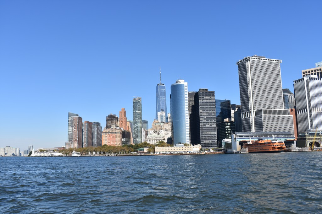
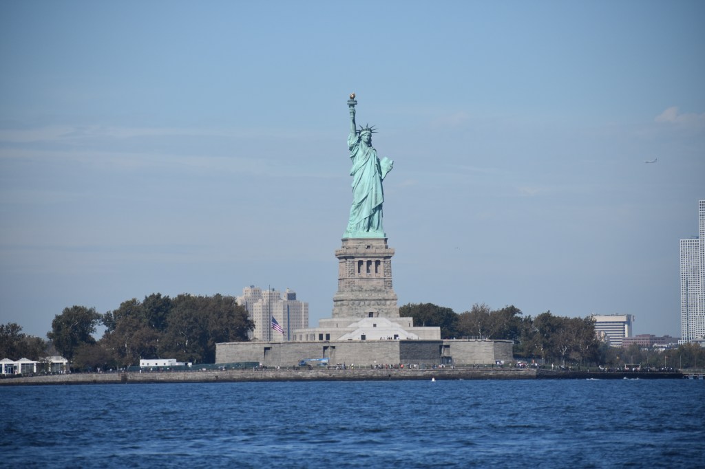
Lots of interesting things to see along the East River. The water is deep right up to the streets and buildings at the shore. With all the pedestrians I was at times able to prove that Andante actually moves at a walking pace. If you ever wonder whether New Yorkers care about climate change, consider that the FDR is just below the level of the river with only a tiny seawall protecting a major Manhattan artery. New York Hospital is where my parents worked when we lived in the city. The UN was not in session so we were able to pass very closely. During major events vessel traffic is re-routed around the other side of Roosevelt Island for security.First glimpse of Ms. Liberty from under the Manhattan and Brooklyn Bridges. I learned that a sailboat is not the best camera platform. More than half the photos I took have some bit of rigging in the picture, sometimes faking out the autofocus. This one isn’t too bad.Freedom Tower from under the Brooklyn Bridge.The Battery and the Staten Island Ferry terminal. The East River is to the right, the Hudson on the left.I was able to get right up to the buoys marking the restricted area around Liberty Island. This was probably the busiest area of the harbor with all the tugs, tour boats, ferries, kayakers (really) and helicopters. The helicopters didn’t impact my navigation but there sure were a lot of them.
Beyond the harbor is the Narrows and the Verrazzano Bridge. Its an impressive span – it was the longest in the world until the 1980’s. Its also quite tall so that both Andante and larger vessels can pass easily. Every time we go under a bridge I look up and wonder just a little if we’re going to fit. The mainsail was hoisted with the equivalent of two reefs. The sail was just providing a little extra thrust and stability as we motored through the choppy harbor.
Our day ended near Sandy Hook in Atlantic Highlands, NJ. I think highlands may be overstating it a bit as the hills are pretty modest. But I read that this is the second highest spot on the Atlantic coast after Maine so I guess it is deserved. In any event, the man-made harbor is cozy and well-protected and has services like fuel and water that I’ll need before moving on.
I really looked forward to this leg of the trip. It was very satisfying to both get the logistics of this just right and to enjoy such nice conditions, especially after the past few days in Long Island Sound.
On to the next challenge: Sandy Hook to Cape May. As of right now the weather is looking reasonable for a departure late tomorrow or early Saturday.