It took four more days to transit the ICW to Andante’s winter home in North Carolina. The remaining 170 miles were both long and short. We put in one more very long day running from the Pungo Ferry Bridge to the head of the Alligator River, arriving at our anchorage after dark. The day included a treat in our transit through Albemarle Sound, where we could unfurl the sails again and give Andante a bit more room to roam. While we weren’t keen on running the ICW at night, it was less daunting here since Dave had visited the same anchorage several years prior and was confident in the available space, depth and holding. Nonetheless, we were very thankful for our radar, which guided us safely past several unlighted marks after dark, and for our charting program, which led us directly to Dave’s previous anchorage. In fact, we dropped the anchor almost exactly where Andante had been two years prior!
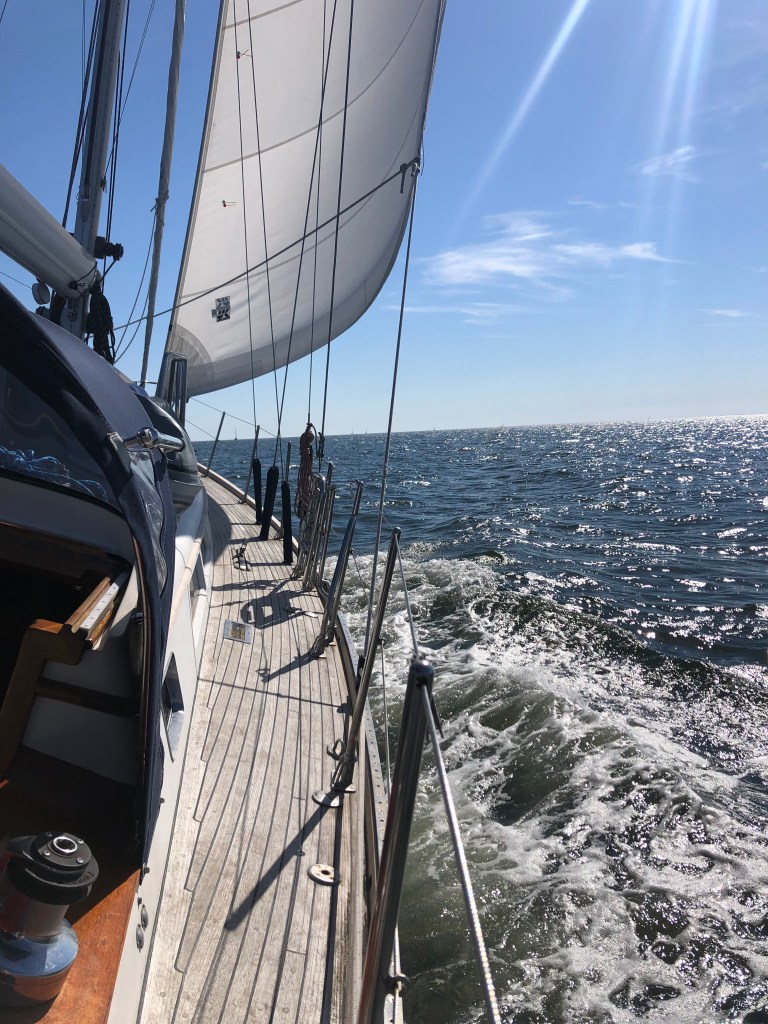
The long days allowed us to plan for a few shorter hops in the final days of our trip. The first would take us through one of the longest straight land cuts in the Pungo River – Alligator River Canal. Along this very narrow straight section of ICW, we enjoyed ever-warming temperatures, watched a bald eagle flying overhead and spotted great herons keeping watch along the shoreline. The shorter days underway were made even more enjoyable as we unfurled our sails one last time while transiting the Pamlico and Neuse Rivers.
With extra daylight hours on anchor we started working through a long list of jobs to get the boat ready for our arrival and final haul-out. Before we knew it, we were tying off lines at the dock on Core Creek, looking forward to standing on land again and greeting my parents. But we were also sad. Sad to have this great adventure behind us and sad to watch the cohort of boats we had traveled with continue south to their own destinations.
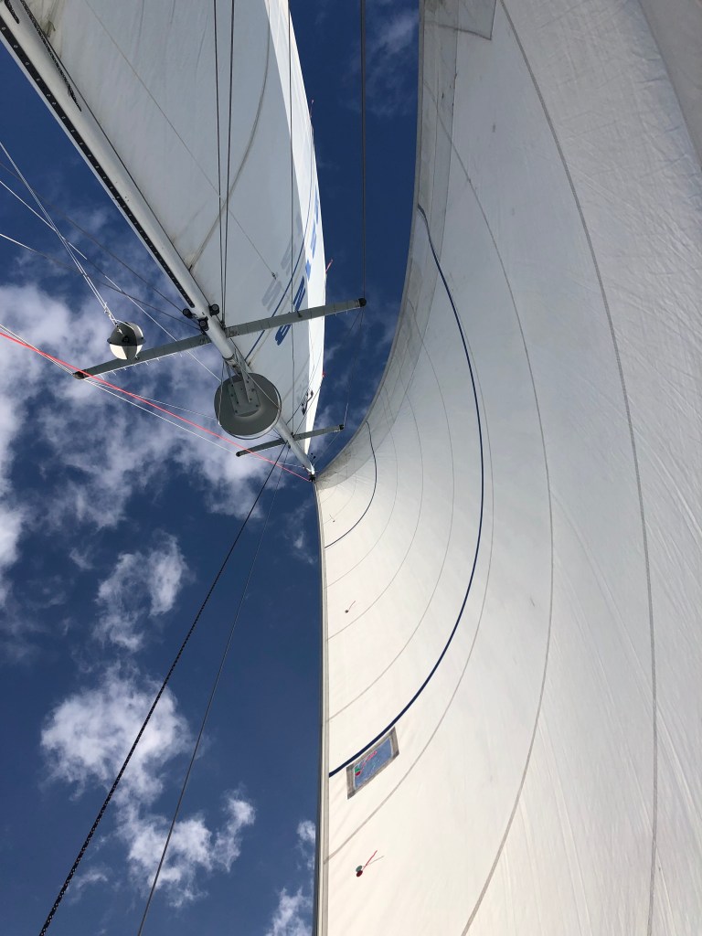
Sunset on anchor in Bellhaven, NCSailing in the Neuse River. The mainsail is stowed because we had hauled the dinghy onto deck for the final haul-out. Last few miles with canvas stowed and dock lines readyArrived!And out.
The next phase of our trip would be very different than the first, where we transitioned from sailing in wide open waters to “driving” along miles and miles of dredged channel through some of the most remote marshland I have experienced on Andante. We entered the intracoastal waterway (ICW) at mile zero and would spend the next 200-ish miles carefully following a very narrow “ditch” through some extremely remote areas to our destination just north of Beaufort, NC. At times, it felt a bit like driving 95 south to North Carolina, requiring attentiveness in navigating other traffic in the confines of the channel, biding time waiting on bridge openings, looking out for hazards (like tugs pulling barges, free-floating logs, tree stumps and uncharted shoals) and generally staying “in our lane”. We were thankful for our autopilot, which allowed us to make small continuous corrections to our course without having a hand on the wheel, and for the bathymetric survey data provided by the Army Corps of Engineers, which warned us of areas that needed extra attention. And in case we got too comfortable at any given time, the ICW would throw us a reminder in the form of a half-sunk motorboat or an entire felled tree extending partway into the channel.
On a trip like this, you focus a lot on the weather and the state of the boat and her crew. Outside concerns, beyond getting safely from point A to point B, fall away rather quickly. In fact, time becomes somewhat irrelevant, beyond knowing how many hours until sunrise and sunset or high/low tide. Not so on the ICW. In our transit south to North Carolina, we would navigate under 14 bridges and through 1 lock. Several of these bridges and the Great Bridge Lock opened on a schedule and we encountered the majority of these in our first day in the channel, making for a very busy day. We arrived at the first low bridge at mile 5.8 around 10:50 Sunday morning, noting immediately that a small handful of sailboats were anchored just north of the bridge. Usually this bridge opens on demand, but on hailing the tender we were informed that the bridge was operating under a restricted schedule (beginning that day) and would only be opening at 8 am, noon and 6 pm. We were not the only ones caught unaware!
It’s not unusual to have to wait an hour for a bridge to open so we were prepared to motor in circles until its opening. But then I looked at my Apple watch, which was clearly paying closer attention to the outside world than we and our onboard instruments were! It told us that we had an extra hour to wait and we quickly realized we had completely forgotten to “fall back” for the end of daylight savings. There’s a lot you can’t control while cruising, so you quickly learn to make the most of ‘found time’. We joined our anchored friends and made the best of a few hours sitting still with the engine off. I took advantage of the first warm temperatures of the trip and enjoyed a shower before getting underway again!
Delayed bridge openings create bottlenecks and act to group boats together for subsequent legs of their journey. We would spend the next few days on the ICW leapfrogging the same group of boats, which was oddly comforting. The options for anchoring enroute were limited and we found ourselves relying on Dave’s track from his journey south a few years prior. The first night we anchored just outside the very narrow channel north of the Pungo Ferry Bridge and enjoyed a spectacular sunset. We left all our lights on to provide visibility for anyone brave enough to travel after dark (mostly tugs with barges). The quiet was deafening and like none I have ever experienced.
Keeping track of the bridges and navigation landmarks to come in cruising guides and logs from prior trips, while keeping a close eye on our position in the “ditch”Waiting for the water to drop in Great Bridge LockShrimp boats lining the edge of the ICW
After two months in the beautiful Bahamas its time to head towards home.
Andante and I have a long trip ahead and, frankly, photography and blogging have not been high on my list of priorities. I will try to keep folks updated on my whereabouts and will share interesting experiences. Eventually.
We departed the Exumas on April 5. Today (April 20) we arrived at Little River Inlet close to the border between South Carolina and North Carolina and roughly the halfway point of the 1500 nm return trip. The weather hasn’t been conducive to long offshore legs but we keep pushing forward everyday regardless.
The legs completed so far have been the following:
Staniel Cay, Exumas to West Bay, New Providence
West Bay, New Providence to North Bimini
North Bimini to Fort Pierce, FL
Fort Pierce, FL to Melbourne, FL
Melbourne, FL to New Smyrna Beach, FL
New Smyrna Beach, FL to St. Augustine, FL
St. Augustine, FL to Fernandina Beach, FL
Fernandina Beach, FL to Charleston, SC
Charleston, SC to Price Creek, SC
Price Creek, SC to Georgetown, SC
Georgetown, SC to Little River Inlet, SC
As always you can check our current position using the link found on the trip page.
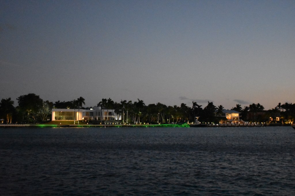
We’ve spent the last couple of days anchored offshore of the old Nixon winter white house site near the Key Biscayne Yacht Club. This spot is also just a few blocks from where Paula and Cheese and Basil and I lived in the mid 1990’s.
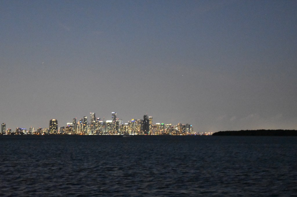
Through the magic of reciprocal privileges and a timely letter of introduction from our RBHYC commodore I was able to gain access to the club to use their dinghy dock to access groceries and water and covid testing. It was fun walking around the town again after so many years. The yacht club itself is much bigger and fancier than when we lived here — but the people are still super friendly and helpful and the view of downtown Miami across Biscayne Bay is still spectacular.
All the water tanks are topped off, fresh fruits and veggies are loaded, I’ve got my health visa, the weather forecast looks good and we’re ready to go. We’ll depart late this evening for the quick overnight trip across the Gulf Stream to Bimini. The plan is to stay at a marina in Alice Town for the first night (or possibly two) to get my bearings and wait for the next front to pass. Then I expect to head further east across the bank to the Berry Islands. Or not. From here on there is no real schedule or itinerary.
Andante in Key Biscayne. More boats arrive every day to wait on weather for a Gulf Stream crossing. After several weeks of lousy conditions it looks like the next 2-3 days will provide light winds and reasonable seas — so expecting to motorsail most of the 50 miles from here to Bimini.Key Biscayne Yacht Club. A bit too fancy for my taste but amazing view from the bar.The old Nixon helipad is on the right side of this photo. The homes along the shore are in all different styles and some are really attractive — but its the view from the houses that makes the location appealing. And I get the same view (maybe better) from Andante for free.The view. Even better when in focus.After weeks of worrying about logistics it was crazy simple to get a covid test from this little trailer about a mile walk from the yacht club. Same-day appointment for a rapid PCR test that gave a result within two hours. That allowed me to get all of my Bahamas health visa and immigration paperwork out of the way. Yay.Road ibis. Use caution.The moon over Miami was underperforming this week even with an assist from Jupiter.
Off to a staging harbor to prep for the next few months.
The Banana River west of Port Canaveral was a really interesting anchorage. Lots of wildlife pressed right up against a major industrial area. Interestingly the wildlife (birds and dolphins, in particular) seemed not to care. The pelicans seemed happy to roost on man-made structures and the dolphins have figured out how to use the locks to go back and forth between the ocean and the lagoon.
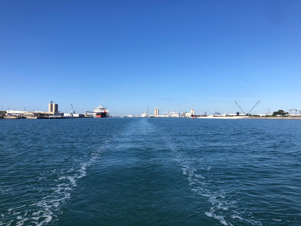
We said goodbye to Port Canaveral in late morning and headed for Fort Pierce. On the way out we passed a couple of gigantic cruise ships which has arrived overnight. Andante felt very small and secretly wished for a water slide of her own.
Leaving Port CanveralWe passed two cruise ships berthed in Port Canaveral on our way back to the Atlantic. I’ve never been on a cruise ship like that and have some difficulty understanding the attraction — but they are still really interesting to me. The first one (MSC Meraviglia) was just huge. The second (Royal Caribbean Mariner of the Seas) had a cool twisty waterslide on the upper deck. Sailing nicely out of Port Canveral. When the wind picked up in the afternoon it was almost directly in front of us. We tacked back and forth for a while but finally gave in shortly before nightfall and turned the engine on. Lying on my back on the foredeck this was my view for much of the morning. While this one missed us a subsequent storm hit us with torrential rain and some pretty good winds just a few miles before the entrance channel. I was glad to have the sails down at that point.When I’m not on deck staring at the sails I’m generally down below staring at screens at the nav station. I use a chart plotter on my Mac (OpenCPN) to plan our route and monitor progress underway. Radar and AIS are very useful, especially at night. Its surprising how many fancy expensive boats (especially powerboats) don’t have AIS. I had a chance to do a few sun sights on this leg but haven’t worked them up yet. Now that its warm enough to hold a sextant in bare hands I’m hoping to work on my celestial skills over the next couple of months.Andante anchored in Fort Pierce the morning after arrival. The water is warm and clear and greenish-blue. And full of dolphins and jumping fishes. On one side of us is a cluster of mangrove islands with lots of birds. On the other side of us is the Fort Pierce Coast Guard station and a waterfront bar that offers really loud (but not very good) live rock music all evening. Bar not shown to protect the guilty.
So what next? After considering several scenarios I think the most compelling option is to head from here to the Bahamas. From Fort Pierce it is only 80 nm to West End. Getting from here to there will require completing some maintenance items, restocking food and supplies and waiting (and waiting) for an appropriate weather window. And all of this needs to be coordinated with obtaining a Covid test that is required for entry.
I chose Fort Pierce as a staging location exactly because it provides access to all of the products and services I need for this logistical puzzle while also providing the option to anchor out (free) for an arbitrary duration. I’d be much less inclined to wait for perfect weather if I was trapped in a marina paying more than $100/night. The dinghy ride to shore is long and can be wet — but the City Marina provides a nice secure dinghy dock that they encourage visiting boaters to use. A Lyft ride to downtown or the grocery store is about $7. So the infrastructure is here to make this work.
I’m still looking at options for Covid testing. The Bahamas will accept a rapid antigen test but it seems that appointments for a drive-through PCR test are more widely available. Never mind that I don’t have a car. The real trick is that the test result must be no more than 3 days old when you enter the country. With a typical 2 day wait on PCR test results, uncertain weather and the moderately slow nature of our travels it will be tough to meet that requirement.
I understand that the 3 day test age requirement can be waived if arriving by private vessel provided you can prove you haven’t stopped anywhere since the test. So at the moment my working plan is to wait for a good weather outlook, schedule and get a Covid test (hopefully Lyft is OK with a drive-through swabbing) and start sailing south along the Florida coast staying in cell range without stopping until I am emailed the test result. Then I can divert east across the Gulf Stream with an intended target of West End, Grand Bahama. Or if the test result takes really long to deliver, Bimini.
So I’ve made a decision and have something like a plan. It remains to be seen if it is a good plan but fortunately I’m flexible and in no rush. We’ll make the best of whatever happens next.