Our trip down the long and winding ICW from Beaufort has not been unpleasant. But it was definitely a pleasure to get out into deeper water and really sail for the first time in several months. After an enjoyable two nights dockside in Charleston (and many long walks around the city) we took advantage of a brief weather window to run offshore South Carolina and Georgia to the St Mary’s River inlet and Fernandina Beach, Florida. There was great sailing weather for the first third of the 28 hour trip. We covered many miles on a three-sail broad reach about 5 miles offshore before the wind got fickle and died. That left us with an overnight motor in glassy seas under a nearly-full moon. Not unpleasant at all.
At the entrance to the St. Mary’s River we were greeted by the guns of Fort Clinch. Andante was not intimidated. We were a bit taken aback by the industrial waterfront of Fernandina Beach and the odors of the pulp mill but we found a nice secure mooring to hold us through the gale that arrived overnight. My instruments recorded a max wind of 52 knots. Wheee!
Its still blowing 35-40 kts as I write this –so expect to stay put until at least tomorrow to allow the wind and seas to moderate a bit. The goal is always to sail the boat so wind is good — but wind direction and sea state matter a great deal. As we head south along the east coast of Florida the ideal weather is something like 15-20 kts from the west. These conditions would allow us to sail at full speed a few miles offshore where the wind is strong but locally-generated waves are fetch-limited. We might still see swell from distant storms but even large swell is more comfortable than short steep waves. These are the general conditions expected beginning late Monday through Tuesday and into Wednesday. I hope to take full advantage of them. The near-term plan is to push south to Port Canaveral and possibly further (Ft. Pierce? West Palm?) as the weather allows.
We should be in South Florida (somewhere between West Palm Beach and Miami) by the end of next week. Once there I’ll take some time to decide whether to head further south to the Florida Keys or make the short hop (around 60 nm) to the Bahamas. Either way, things are definitely looking warmer and sunnier. Yay!
Later today I’ll work on updating the “Trip” link, above, to provide a summary of the 2022 trip legs.
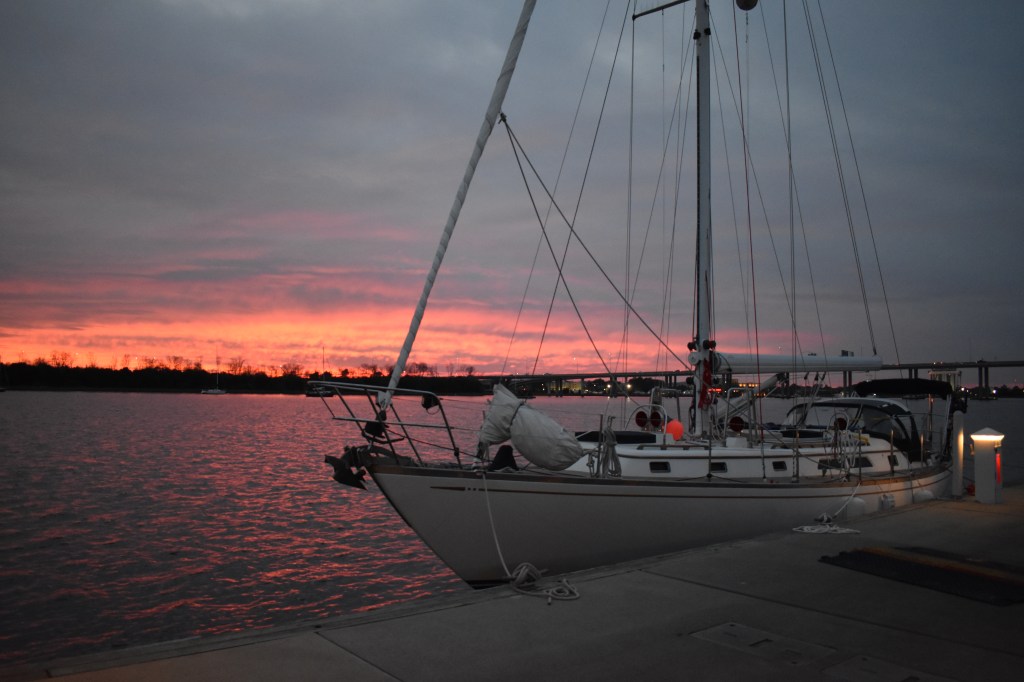
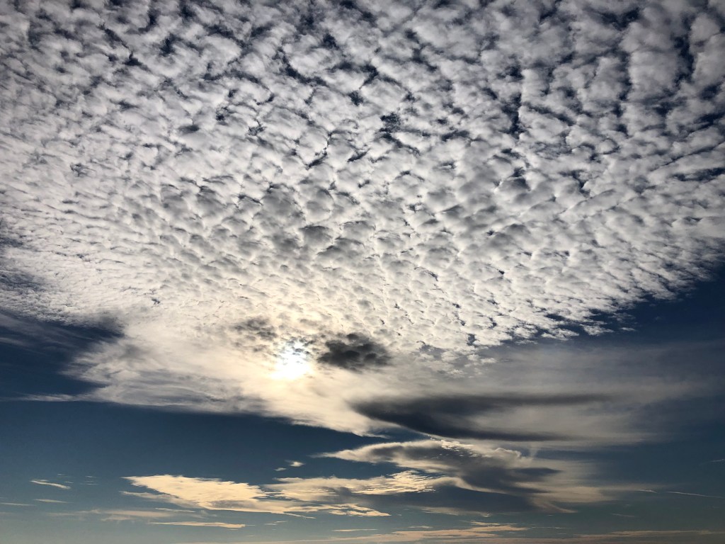
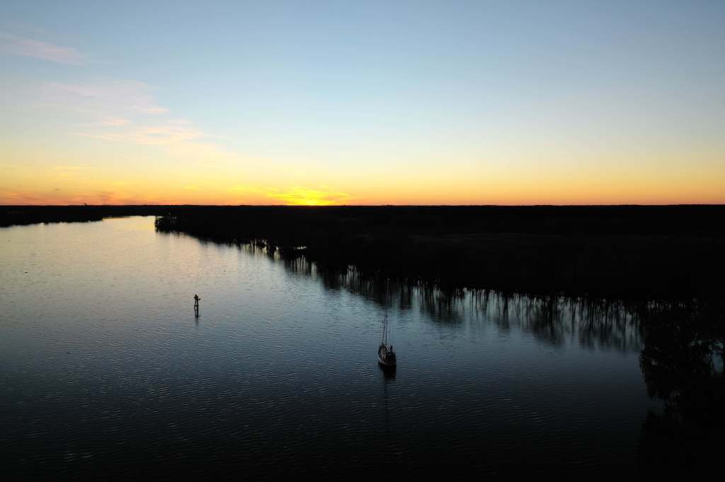
Dockside in Charleston the night before departure.Red sky at night, sailors delight. Or, if you prefer, from Matthew 16:2-3: He answered and said to them, “When it is evening you say, ‘It will be fair weather, for the sky is red’; and in the morning, ‘It will be foul weather today, for the sky is red and threatening.’ Regardless, the sky was extremely red the night before we left Charleston suggesting a pleasant day ahead. We had some traffic on our way out of Charleston harbor. The entrance channel is fairly narrow and with ships and tugs moving in both directions we chose to run just outside the channel between the green buoys and the jetty. I spoke with both the tug and the container ship to let them know our intentions.Finally making some progress under sail. This was just after turning off the engine outside of Charleston with winds 10-15 from the NW. Almost perfect.Sunset at the end of the first day out. Wind has now died to less than 5 kts and shifted to the south — no more sailing for now. Serious chemtrail action around here.Sunrise on glassy seas the next morning. The entire trip crossed an important right whale conservation area and had hoped this would be a good whale watching day. I did see lots of dolphins and birds and a lone sea turtle but no large whales. A little later that morning we saw a nice example of a mackerel sky. These high puffy clouds (cirrocumulus) look like fish scales and indicate that a change is coming. “Mackerel sky, not twenty-four hours dry” is the saying. (Source unknown, but not Jesus). Another correct prediction – by late evening we were being walloped with strong wind and heavy rain. Fort Clinch on Amelia Island at the mouth of the St. Mary’s River. Lots of beachgoers and kayakers on a warm Saturday morning. The opposite side of the river is Cumberland Island, Georgia. I’m pretty sure we strayed across the centerline so we’ve now passed through all 12 states between Massachusetts and Florida.Heading south on the Amelia River. I’m guessing this is a pulp mill but can’t get past how the big pile reminds me of the mashed potato mountain in Close Encounters. Also tough to get past the smell. Fortunately we’re upwind today.The view from our mooring in Fernandina Beach before the wind started blowing. The view in the other direction. Given today’s winds I don’t expect to put Dinghy in the water and explore the town. Instead I’m using the time to catch up on some cleaning and maintenance. And baking some bread — because I actually need bread and not just as an excuse to heat the cabin.
From southern North Carolina into South Carolina the ICW is extremely narrow with many areas of severe shoaling. Driving this stretch required a lot of concentration to keep Andante in the center of the channel and out of the mud. And we’re definitely driving and not sailing. There have been a few rare occasions to hoist a sail and gain an extra knot of boatspeed (and a smile) but the engine is on all day long.
From Camp Lejeune we pushed south with brief overnight stops in Wrightsville Beach and then Southport where we loaded up on fuel, water and some fantastic shrimp and grits. The next day we weathered a gale in the marshes of Little River Inlet, SC before continuing on past Myrtle Beach and into the amazingly beautiful Waccamaw River. The owls were frighteningly loud but it was too cold to see any alligators. This was definitely one of my favorite overnight stops so far. Probably buggy in warmer seasons so perhaps lucky to enjoy it now.
We arrived in Charleston, SC on January 12 and plan to stay here for a day or two until a weather window allows a coastal passage to Georgia. South of Charleston and all through Georgia the ICW is essentially impassable due to shoaling except at mid/high tide. It will be much more efficient (and fun) to sail outside. This short break gives me a chance to top up fuel and water tanks and stretch my legs with walks through the city.
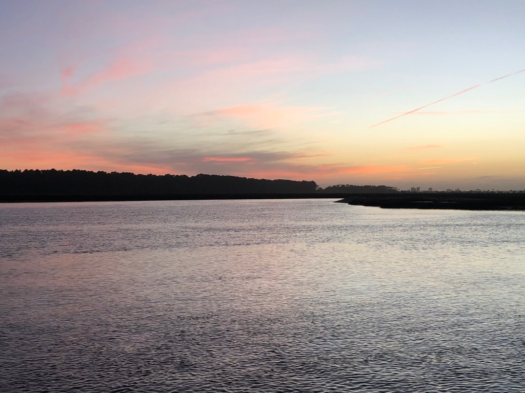
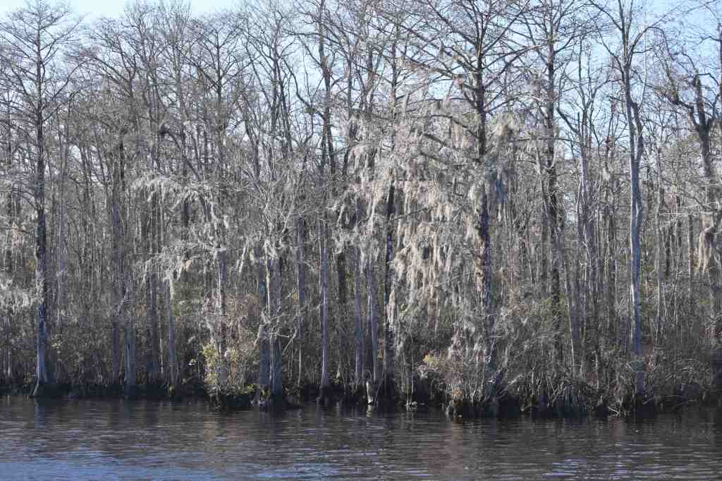
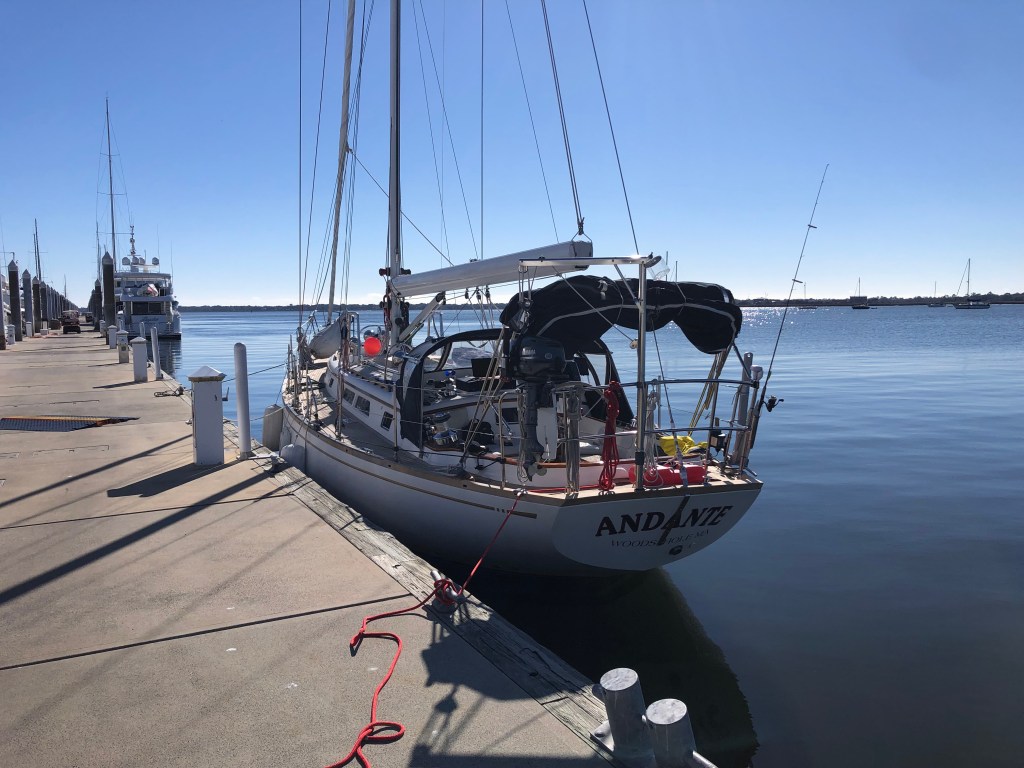
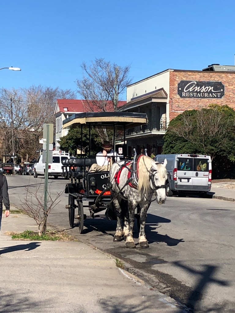
Southport, NC is a cute little town and Southport Marina was a great stopover for fuel and a hot shower.I recommend the shrimp and grits at Fishy Fishy Cafe in Southport. The local shrimp have lots of flavor. The Bud Light does not. But I enjoyed it anyway.Sunset in Little River Inlet on the NC/SC border. I didn’t realize South Carolina had offshore gambling until the “Big M Casino” steamed past. Glad to have good lighting and AIS. Between Beaufort, NC and Charleston, SC we cleared 30 bridges. Most of those are a standard fixed vertical clearance (65 ft +/-) but quite a few (including 3 in one day this week) require swinging, raising, or floating the span out of the channel before proceeding. We’ve run into a few delays due to bridge maintenance but generally all works smoothly and the bridge operators are very accommodating.Spanish moss on the banks of the Waccamaw River. Miles of narrow winding channels surrounded by nothing but swamps and trees. Quiet spot on the Waccamaw River.Nice.Coast Guard doing two-boat drills in Charleston Harbor.Andante on the “Mega Dock” at Charleston City Marina. We were probably the least “mega” boat in the place — but it was very nice.The Ubers in Charleston may be a little slower than elsewhere. This is a very pretty city to walk around with lots of history. College of Charleston is a beautiful campus. And everyone seems to be extremely good about mask-wearing.
We left Morehead City just after dawn and had a beautiful ride through the port and into Bogue Sound.
Bogue Sound is very scenic with many small sandy islets and lots of birds. One friend followed us closely for several miles. (This is my first attempt including video in this blog. Hope it works.)
We made good time and with the wind behind us were even able to carry a headsail for a while. The last few miles of the day cut through USMC Camp Lejeune. There were some interesting contrasts with beautiful marshes and lots of wildlife in a live-fire training area.
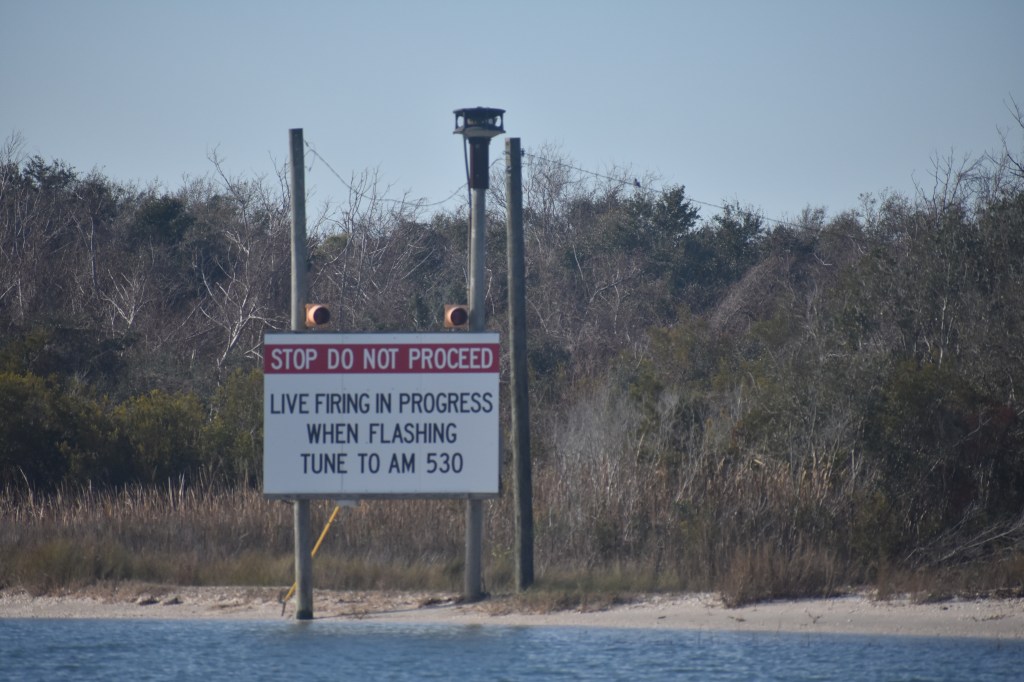
Fortunately the lights were not flashing when we arrived. There were definite sounds of gunfire and occasional louder explosions in the distance.The barrier island separating the ICW from the Atlantic is very narrow here. I could hear the surf breaking as we sailed past. Do you think all those hunters wearing orange know they are dressed like a target? I hope the birds understand what the flashing lights mean.This swing bridge is within Camp Lejeune and is operated by the Marines. They were very punctual.
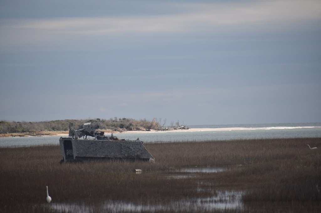
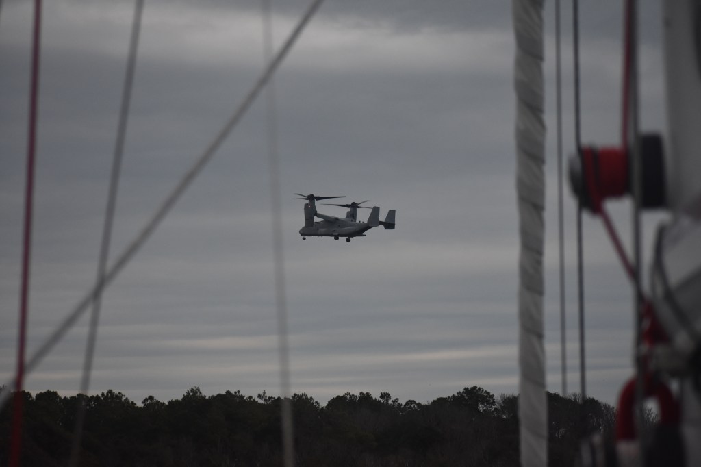
We anchored for the night in Mile Hammock Bay, a well-protected little harbor apparently used by the Marines for launching landing craft. It was a good place to ride out the gale that arrived overnight but was anything but quiet — the little harbor is adjacent to a busy helicopter landing area.
These two circled around playing follow-the-leader for hours.This looks like fun.
The 3-4 weeks of actual work on Andante stretched over two full months to accommodate the holidays. It was great to be home and see everyone and eat way too much. But now its January, its cold, and we need to get south. As fast as this moderately slow boat can go.
We left Bock Marine on January 4 for a short trip to Beaufort. It was good to get underway again and test out the new steering and engine controls for the first time. Everything worked smoothly and we anchored for the night in Taylor Creek on the Beaufort downtown waterfront. I assembled dinghy and motored the 100 yards to shore for a nice dinner with Bill and Anne. From the anchorage I could see some of the wild horses on Carrot Island frolicking on the beach. Never mind that all I have to share are still pictures of seemingly relaxed horses. There was indeed frolicking.
Bock Marine in the rear-view mirror. I had a good experience here and would definitely recommend it to anyone looking for a DIY yard.Andante anchored in Taylor Creek in Beaufort, NC. Sitting close to her lines with half fuel and almost no water — but lots of food. Will be interesting to see how much this changes when I fill the water tanks.Evening in Beaufort.Wild horse on Carrot Island, Beaufort, NC.
The next day we stuck our head out into the Atlantic and sailed south for an hour before deciding the conditions were not at all what was forecast. It was very windy and rough with frequent heavy rain squalls. Not fun, so we turned around and headed back in the inlet.
Its easy to second-guess a decision like that. But after deciding to return to port not only was I immediately more comfortable, I was reassured by two significant good omens: A big pod of dolphins began following the boat and leaping alongside as soon as I turned around. And upon entering the inlet we were greeted with a full rainbow.
Full rainbow over Beaufort Inlet.
We anchored for the night near the Coast Guard base in Morehead City. It wasn’t a particularly quiet anchorage but was convenient to the ICW and allowed us to get an early start the next morning. With the very short periods of fair weather between frontal systems its looking like we’ll continue south along the ICW rather than offshore – at least for now.
Rolly anchorage inside Beaufort Inlet just off of the Coast Guard base at Fort Macon.