
Miles 0 to 136: Norfolk, VA to Belhaven, NC
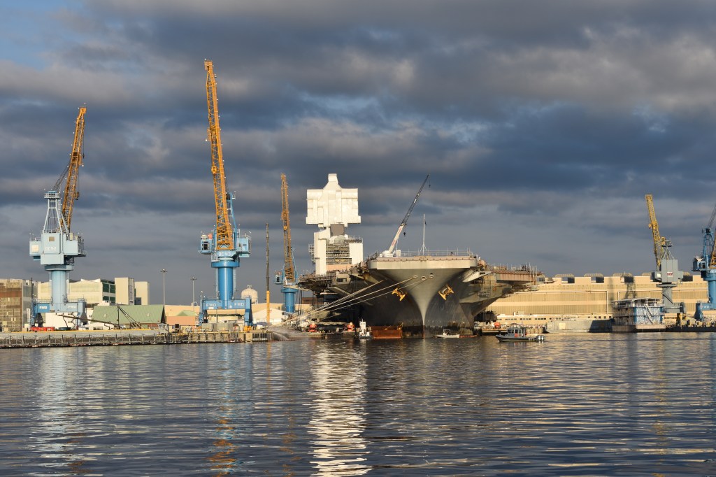
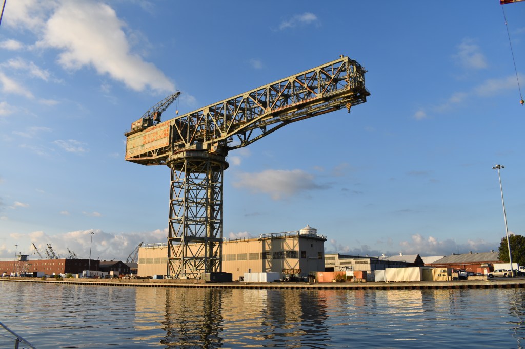
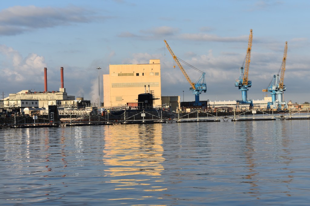
The origin of the ICW in Norfolk is about as urban and industrial as a place can be. Tall buildings, commercial activities of all sorts, trains, planes, heavy industry and shipbuilding. By the afternoon on the first day we left all of that behind.

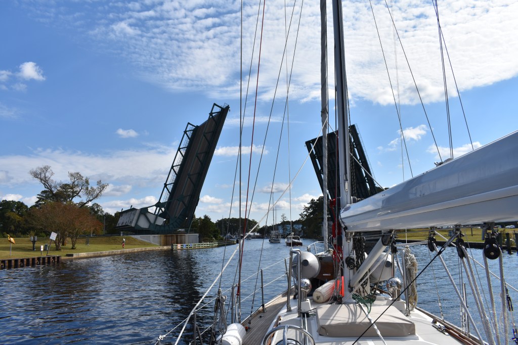
On the first day we passed through 13 bridges (auto and rail) and one lock. The bridges were all different. About half of the bridges required some sort of movement (lifting or swinging) to allow a tall sailboat to pass through. Some bridges operate on a fixed schedule, others open on request. Railroad bridges generally remain open and passable until a train approaches.
Odd as it may seem, I don’t actually know the height of Andante’s mast. I’ve measured and figured in several different ways but am only really confident to +/- 1 foot. My best guess is that the tip of the VHF antenna that sticks up above the masthead is 61 feet above the waterline. Most fixed-height ICW bridges have 65′ clearance above mean high water so we should be fine — but this can vary a bit with wind and extreme tides. Bridge pilings generally have markers that show the current air draft and based on these I know we’ve successfully passed through bridges as low as 63.5′ on this trip. That’s low enough for me.


Shortly after leaving the Norfolk area boats have to choose whether to follow the (straighter, deeper) Virginia Cut or detour into the winding, shallow, more wild Dismal Swamp Canal. I’d like to seem them both at some point — but Andante’s draft is not a good match for the Swamp route.

Just a little further along the route the Great Bridge Lock was an interesting experience. Once an hour about 10 boats are loaded into the lock chamber and secured to the walls. Then the gates are closed and the water level allowed to rise — on this day the change was only about a foot. Then everyone filters out and loiters while waiting for the adjacent bridge to open.


Soon after leaving the tidy little town of Great Bridge we settled into a landscape that was far less manicured and far more monotonous. Swampy land, scraggly trees, and ever-present stumps and submerged logs along the banks. We tried to stay in the center of the channel all the time to avoid bumping anything. Even with GPS I would not want to transit these narrow channels at night — too many barely-visible obstacles to be avoided.

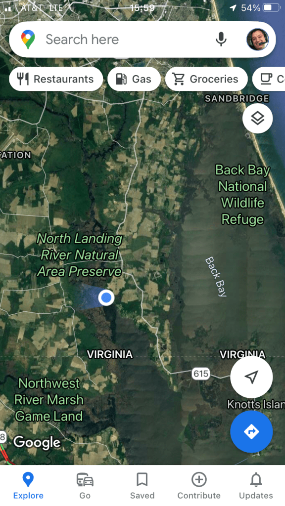
The first night we found a spot to anchor just outside the channel in a bend south of the Pungo Ferry Bridge about two miles north of the NC border. Later that evening I checked Maps to see what was nearby: Lots of nature, not many people.
The second day out we pressed on through northern North Carolina crossing Albemarle Sound (under sail) and the Alligator River. We spent the night in a small cove just north of the Alligator River – Pungo River canal, near the 100 (statute) mile mark on the ICW.

The Alligator River – Pungo River canal was apparently the final piece of dredging required to complete the 1090 mile Atlantic ICW. While it may be a feat of civil engineering, it is not a particularly exciting or photogenic passage. It is long, straight, and mostly featureless for 20+ miles until reaching the Pungo River.

Tonight we are anchored in Belhaven, NC near ICW mile marker 136. Its been a cold and wet and windy day and more stormy weather is anticipated. As always, tomorrow’s movement will depend on tomorrow’s weather. If it looks messy (and cold rain is forecast) we may just stay here for a while.
A faithful reader of this blog asked about how I stay warm. Andante does not have a heater. Perhaps a diesel heater will be a project for next year. For now I have warm clothes, a sleeping bag, and a limited supply of refrigerated chocolate chip cookie dough and cinnamon rolls. The oven is a pretty effective cabin heater so I’ve taken to baking in the evenings to make the cabin more comfortable. The engine’s residual heat also helps. I don’t yet have a solution to cold mornings other than coffee and getting active as quickly as possible.


Looks like the dismal swamp sign is all about enticing boaters to choose that route! Reminds me of the mind games played in the Princess Bride and hence an ominous choice. I wanted to zoom to read the fine print, but could not. Can you translate for us?
LikeLike
“If you haven’t done it yet you don’t know what you’re missing. The Dismal Swamp Canal is lovely and worth much reminiscing.” DISMAL SWAMP CANAL IS OPEN
“DO THE DISMAL” –> Elizabeth City the Harbor of Hospitality
I think the local Chambers of Commerce have an interest in attracting boaters. There were similar overtures made further south to entice folks (especially shallow-draft powerboats) to divert towards the Outer Banks and visit Roanoke Island and Manteo.
LikeLike