
It would be a shame to waste good wind. –Paula
I’ve never made hay, even on a sunny day. But I get it — when the conditions are just right you shouldn’t waste the opportunity to make meaningful progress.
On Sunday morning we set out from Galesville with a plan to sail from the West River to Solomons Island at the mouth of the Patuxent River. But once we reached the open Chesapeake the conditions were simply too perfect: A steady 15 kts from the NW, 1-2 ft seas, sunshine and temperature in the 60’s. We screamed along at better than 7 kts for several hours on a 3-sail broad reach arriving at the turn to Solomons just after lunchtime.
Andante was in great shape having had three days of maintenance. I was well-rested and well-fed. The weather forecast looked solid. So we decided to keep going. And going. All day long. All night long. All the way to Norfolk.
It was glorious.

From start to finish we covered 136 nm over about 28 hours. The night sailing was invigorating with clear skies and lots of stars. The wind slackened in late evening and our speed dropped below 5 kts. But that was ok: There was no point getting there in the middle of the night as I did not want to navigate the busy shipping channels of Hampton Roads in the dark. We still arrived too early and drifted for a while in the anchorage just inside the Chesapeake Bay Bridge-Tunnel waiting for sunrise.

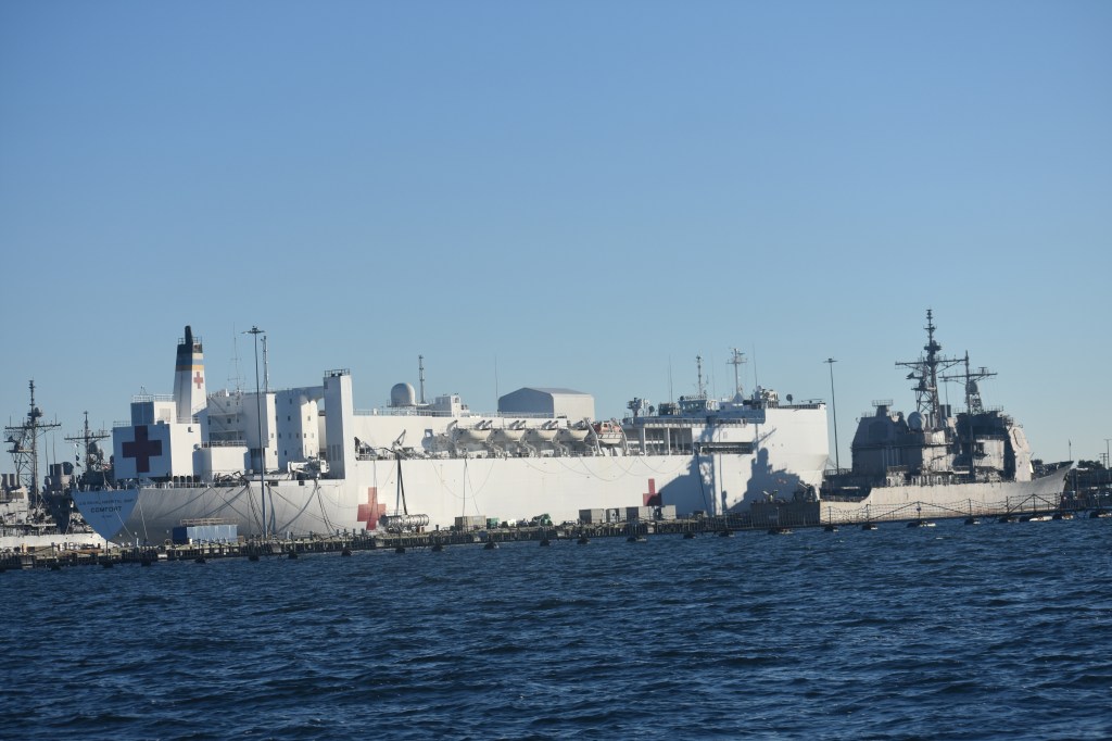
The Norfolk/Hampton/Newport News area is a busy place with loads of commercial and military traffic. Some of it very large.


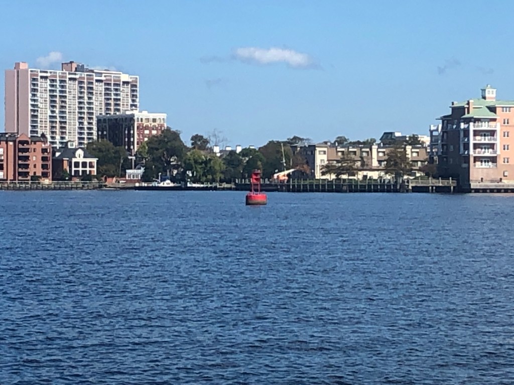
The Atlantic Intracoastal Waterway (ICW) officially begins at red buoy 36 on the Elizabeth River in downtown Norfolk. For whatever reason the Army Corps of Engineers designated that particular spot as Mile Zero on the 1000+ mile ICW. That was our general destination — but we actually ended up anchored right next to it.
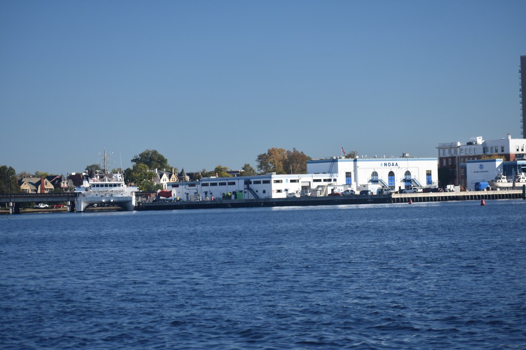
We dropped the hook in Hospital Cove, adjacent to a gigantic Naval hospital and right across the river from the NOAA lab, the maritime museum and the waterfront hotels of downtown Norfolk. And off in the distance we got the first glimpse of the busy shipbuilding industry that we will sail through tomorrow.


I spent the rest of Monday reviewing navigation tips for the ICW and researching potential overnight stops. And then I got some sleep.
