We completed the return trip from the Bahamas to Florida and up the east coast to Cape Cod in just under four weeks. That’s pretty quick for a solo sailor in a moderately slow boat. My strategy was to keep moving every day even if that meant occasionally motoring a frustratingly slow and shallow inside route rather than sailing offshore. In the end this approach proved to be the most efficient way to utilize the scarce and brief weather windows of April.
From Bimini we sailed direct to Fort Pierce. Arriving at 0300, we anchored and entered the US using an iPhone app. No paperwork, no interview. Just press a button, wait 15 minutes, and get a text saying “welcome home.” After a few hours sleep we were underway again heading north on the Florida ICW.
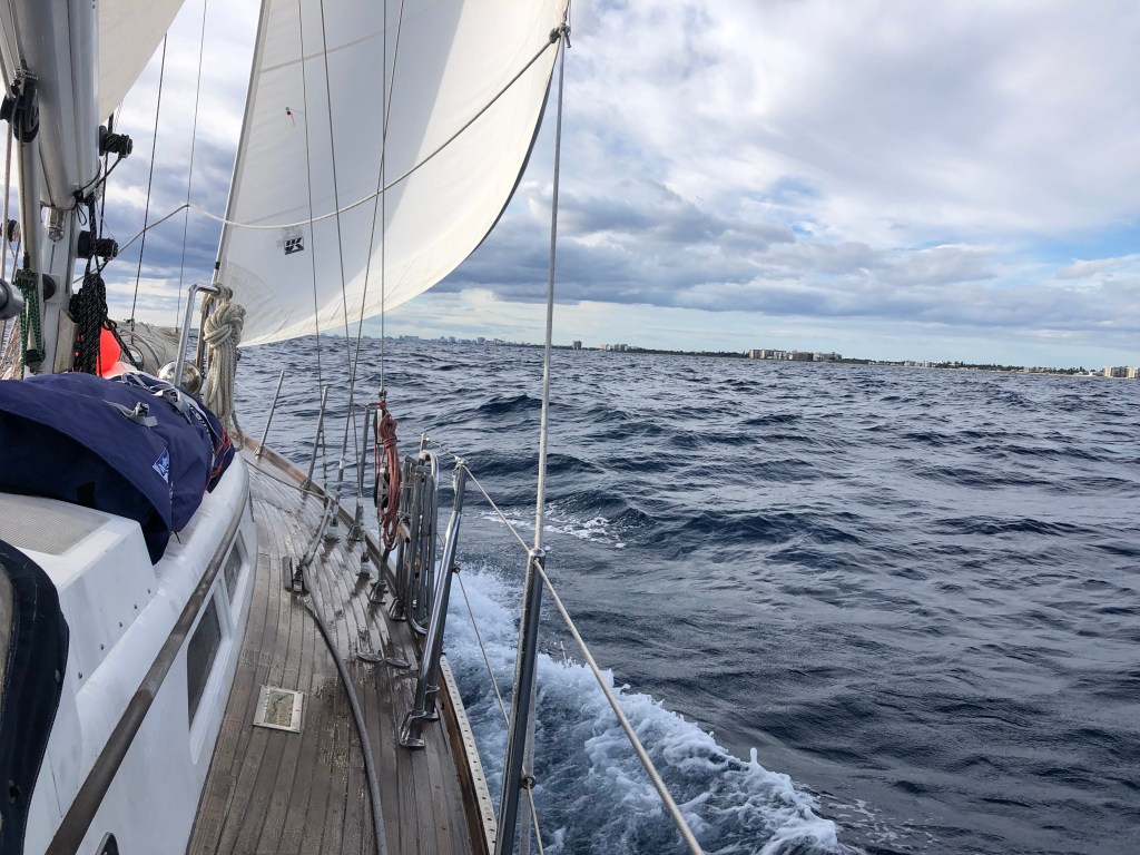
High winds and rough seas kept us inshore for much of Florida, a bit of South Carolina, bypassing Cape Hatteras and the full length of the Chesapeake and Delaware Bays. We did have great offshore sailing from Fernandina to Charleston, Little River to Cape Fear, Wrightsville Beach to Beaufort, and Cape May to Cape Cod. The last leg was a bit over 48 hours and 265 nm — and we sailed all but a few hours of it. Nice way to end a great trip
Strong north and west winds pinned us down on Bimini for several nights. Not the worst place in the world to be stuck waiting for weather.
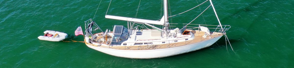
The pool at the Bimini Big Game Club. Good wifi spot.Onshore westerly winds were strong enough to beach many of Portugese Men-of-War on Bimini. Not much remained of their tentacles but there were hundreds of big and small air bladders all over the windward beaches.Fernandina Beach, FL at sunrise. Fernandina in the fog. And the smelly pulp mill steam.Charleston, Hampton Roads, Delaware Bay, New York City. Lots of big ships.Barge traffic while anchored just off the ICW in the SC lowcountry.We spent a quiet night in Georgetown, SC. This was actually the first place I touched land since returning from the Bahamas. Not a fan of the pervasive SC pulp mill stink but this is a neat little town and a pleasant one-night stop.The active pulp mill and inactive steel mill in Georgetown, SC.Wrightsville Beach / Masonboro Inlet at dawn heading to Beaufort, NC.Baltimore LightMotorsailing into 35+ kt winds in the northern Chesapeake Bay. Winds weren’t a factor once we entered the C&D Canal but the long approach was exposed and pretty sloppy. Here we’re showing just the top two battens of the main to provide a little stability in a confused sea. The engine is doing all the hard work.Under full sail approaching the small wind farm off Block Island. Andante back in Red Brook Harbor. She doesn’t look too bad after six months and more than 3000 miles. A few adventure marks here and there. The brown stains on the hull from our inshore adventures in South Carolina will come off easily. Looking forward to some fun regional cruising with my crew this summer.
Bimini was very enjoyable. The Bimini Big Game Club is a great facility and very comfortable. I could easily have stayed for several more days to explore the town and the neighboring islands but a nice weather forecast got me moving again.
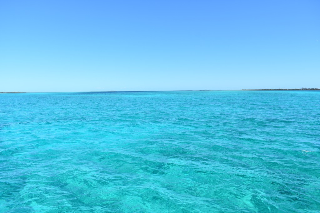
We left Bimini yesterday around noon with the high slack tide. The wind and seas were just perfect for a sail north around the island and onto the shallow bank. The water was so clear I could clearly see individual starfish on the seabed and the shadow of Andante’s mast on the sandy bottom. Around sunset the wind died completely and many of the hours of darkness were spent drifting under a crystal clear sky and coordinating passing maneuvers with freighters and mailboats. Altogether very pleasant.
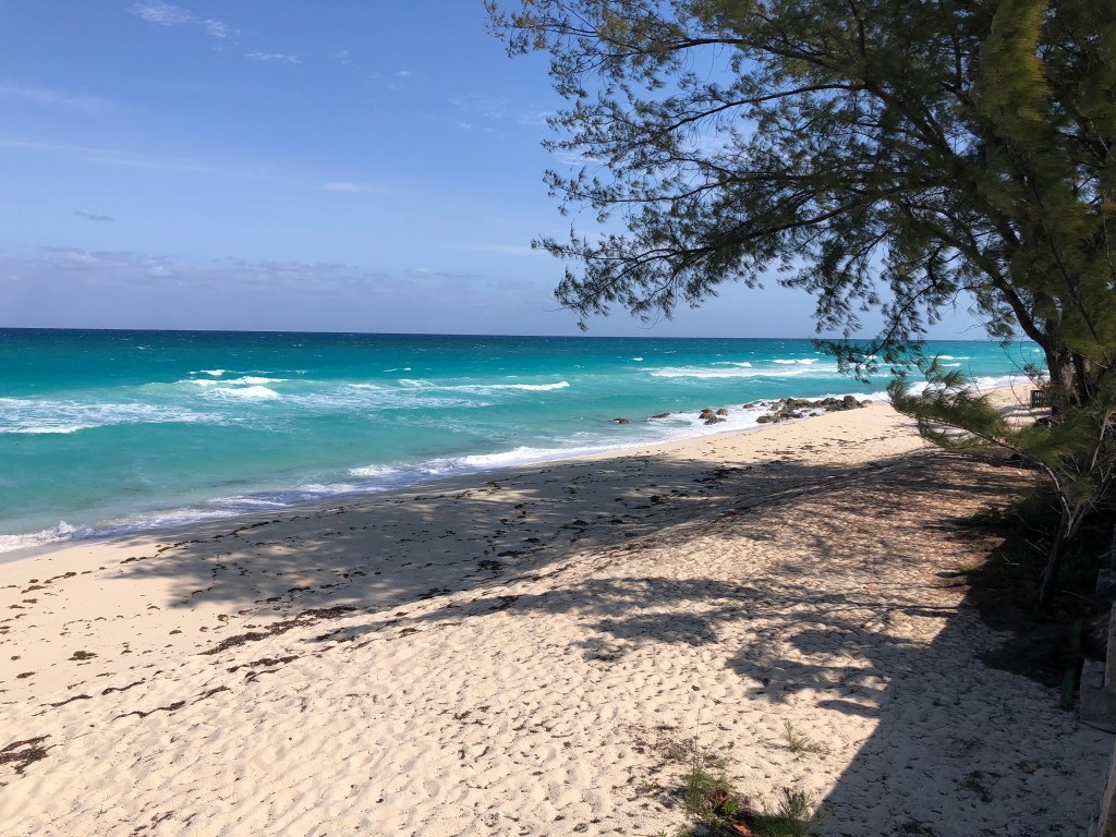
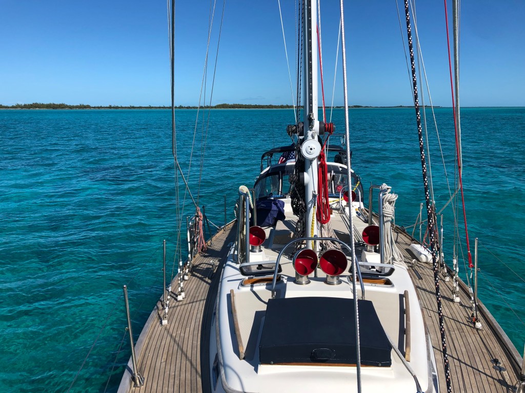
This morning we reached the Berry Islands and found a nice one-night anchorage between Frazer’s Hog Cay and Bird Cay. One-night because its a bit rolly and both islands are private so not much to explore. But that’s ok since we’ll be leaving again in the morning for 5-hour trip to a small harbor on the western end of New Providence (Nassau is on the northeastern side of the same island). Then there will be just one more day-long passage to the northern Exuma Cays where I hope to spend several weeks exploring, hiking, and snorkeling.
Leaving Bimini it was nice to be able to see that the prop was nice and clean while standing on the dock. Just after dawn I heard a big splashing sound outside. I stuck my head up just in time to see a gigantic spotted eagle ray doing a bellyflop just a few feet from the boat. I don’t know why.Sunrise in Northwest Channel just west of Chub Cay. The wind picked up considerably right at sunrise and we were able to sail again for an hour or two before it died again.Andante anchored east of Frazer’s Hog Cay. The water depth is about 11 ft and the bottom is covered with rocks and coral heads with small sandy patches in between.The view of the same location (Andante’s anchorage) around noon. The perceived color of the water is very dependent on the angle of the sun. It is much easier to see coral heads and sandbars when the sun is fairly high and behind you, as in the this photo.
My communications capabilities will be a bit limited for the next few weeks. I hope to have cell coverage in most places — but not everywhere. So I anticipate there may be some delays in updating this blog. Thanks for your patience.
Fort Pierce to Lake Worth Inlet / Palm Beach to Miami.
It was time to move on. The weather windows have been few, far between and brief. To improve our chances for a near-term crossing to the Bahamas we set off for Miami with an intermediate stop in Lake Worth / Palm Beach.
Leaving Fort Pierce we had great conditions and a very comfortable and sunny sail to Lake Worth Inlet. Palm Beach was much busier than Fort Pierce with a mix of commercial and recreational traffic. Temperatures were in the high 30’s overnight and low 70’s during the day.Our anchorage in Palm Beach was very crowded but still pleasant with plenty of shelter to the east. On one side of us was a row of mini-mansions and an endless parade of megayachts. You could hear the waves crashing on the beach just behind these houses. On the other side was the heavy industrial section including a substantial container terminal and the I-95 bridge. The visual contrast between the working port and the homes of the idle rich was pretty dramatic. I’m OK with either view — I find working ports really interesting and spent a few hours staring though binoculars watching the cranes unload this ship.
We left Lake Worth early the next morning. The gusty east wind made for a sporty sail with seas building from 3-4 ft in the morning to 5-7 by the evening. It was lumpy and at times uncomfortable but the conditions made for some of the best pure sailing we’ve had on this entire voyage. We made great time with typical speeds above 7 kts and seeing 8-9 kts occasionally when surfing down a wave. Good fun.
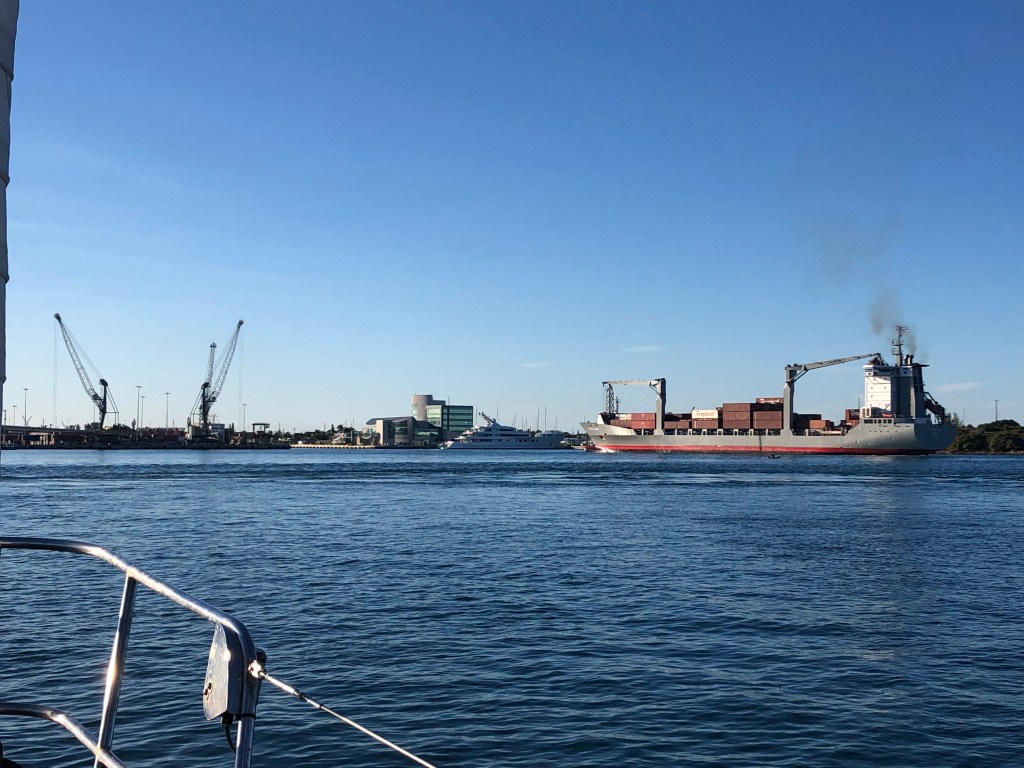
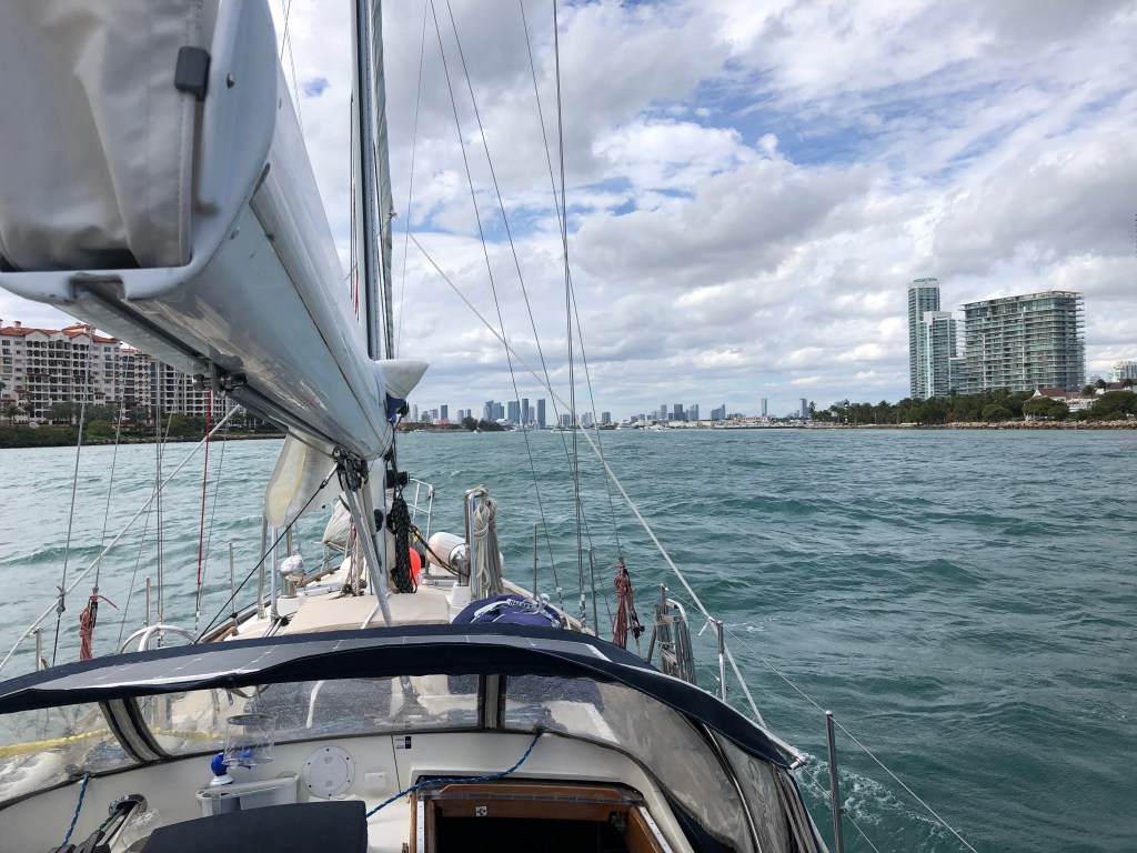
A boat that had anchored near us in Lake Worth also departed around 0400 and we stayed in touch both visually and by radio. Here they are to the east of us just before sunrise.Shortly after sunrise the seas were still pretty mildLater in the day the wind and seas built and we spent a good portion of the afternoon with a shoulder down going very fast with the starboard rail in the water. Even though the conditions were pretty sloppy there were a large number of small boats out kite-fishing for sailfish along the edge of the Gulf Stream. The kite is supposed to impart a desirable motion to a suspended bait at the surface of the water. I didn’t see anyone catch anything but I did see one fisherman leaning over the side orally chumming. Interesting strategy.Entering Government Cut in Miami. Miami Beach is on the right and Fisher Island is on the left. The east wind interacting with a strong ebb tide made navigating the entrance channel challenging. Our arrival at the “wrong” tide was a consequence of sailing ridiculously faster than anticipated. Next time I’ll know to plan for a faster transit.Because of the many cruise ships berthed in Miami traffic is diverted south of Dodge Island in Fishermans Channel. We cruised right under those big cranes and got up close and personal with the big container ship. I wonder if they’d let me use those cranes to load groceries?Finally anchored in Biscayne Bay just south of the Rickenbacker Causeway. I still find the Miami skyline breathtaking, day or night.
After picking our way through the shallow waters near the mouth of the Miami River we anchored just off the beach south of the Rickenbacker Causeway. This less-than-perfect anchorage (noisy, smelly, wavy) is intentional and temporary. Because of the recent weather there is a substantial population of boats down here waiting on a window to cross to the Bahamas. Rather than try to squeeze into a more favorable but crowded anchorage late in the day we chose to hang out somewhere easy and well-protected. But definitely not quiet. And definitely smelly (Virginia Key sewage treatment plant is nearby and upwind). Tomorrow morning we’ll move to a more peaceful and secure location to make final preparations for the jump across the Gulf Stream.
Temperatures here are consistently in the 60’s and 70’s. Barefoot at last.
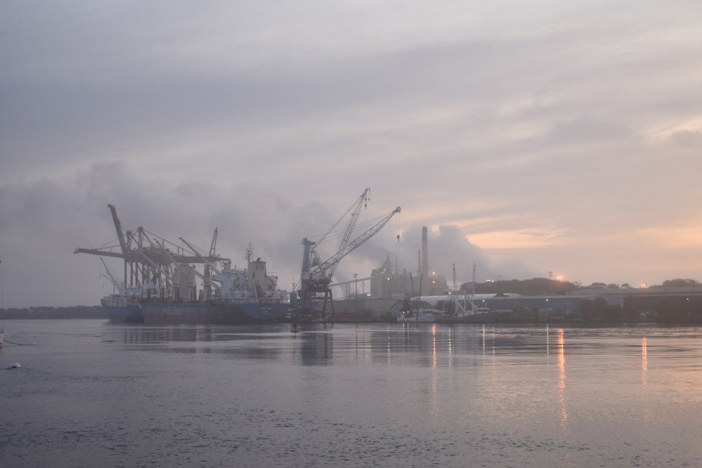
This week’s gale finally blew itself out. I was glad to leave Fernandina Beach yesterday morning with the ebb tide and get back to sailing south. Fernandina seemed like a nice town but I wasn’t able to explore ashore because of the weather so my impression is based entirely on what could be seen (and smelled) from the harbor.
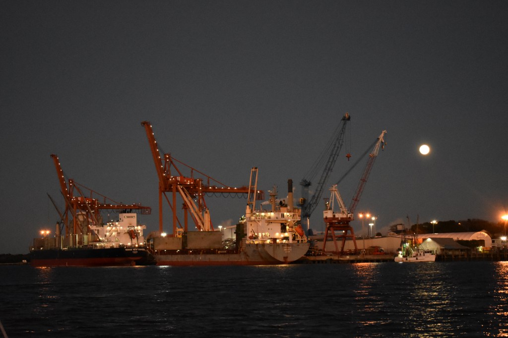
The industrial scenery is improved with a nice sunset and a full moon.
This leg of the trip was about 170 nm offshore between Fernandina Beach and Port Canaveral. When we were able to sail it was glorious. The wind was sometimes perfect for sailing (12-15 kts on or just behind the beam) and othertimes made sailing impossible (2 kts on the nose). Fortunately Andante is blessed with not only a capable sailing rig but a workhorse engine and substantial fuel tankage. I’m happy to use whatever works to keep us moving.
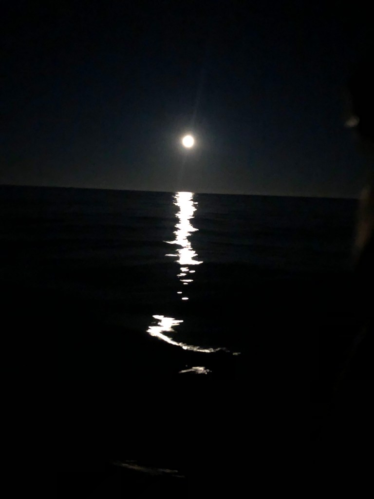
Nice sailing conditions. The line of low cumulus clouds in the distance are out over the Gulf Stream. On this leg we sailed 3-5 miles offshore and experienced a slight southward current most of the way down the coast.Moonrise over a glassy sea.
On our way south we passed Jacksonville at lunchtime, St. Augustine at sunset, Daytona Beach at midnight, and Cape Canaveral at dawn. Since more than half of the trip was at night without much to see I don’t have too many photos to share.
When its dark I spend much of my time below watching the radar and AIS targets on the chart plotter. I pop up briefly to scan the horizon every 10 minutes or so. When all sources indicate that nothing will be happening for 20-30 minutes — no traffic, no buoys, we’re not approaching a coastline, etc. — I set a (very loud) kitchen timer and take a (very short) nap.
St. Augustine Light at sunset.Some of the launch facilities at the Kennedy Space Center on Cape Canaveral. Would be fun to watch a launch from out here. I’m sure the area is monitored and cleared before scheduled launch (and now landing) events.
We pulled into Port Canaveral shortly after noon, got some fuel at a marina inside the heavily industrial port, and then went under a drawbridge and through a lock into the Indian River and a completely different world.
The anchorage I chose for tonight is right next to the western exit of the lock in a shallow area of the Indian River Lagoon / Banana River just teeming with wildlife. Pelicans, herons, all sorts of small birds and more dolphins than I’ve seen the entire trip. I spent the evening sitting in the cockpit enjoying the bright sunshine and watching dolphins jump and pelicans swoop. And it was warm. Yay Florida.
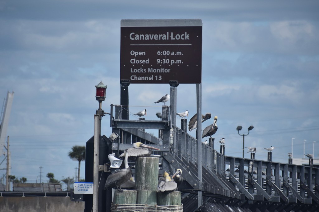
Port Canaveral is a small but busy place.Just beyond the industrial center of the port the barge canal extends westward into the Indian River Lagoon and then the Indian River. A lock is used to reduce tidal flow between the inland waters and the port. Andante locked through with a small squadron of pelicans. Apparently manatee and dolphins pass through the lock as well. Signs warn boaters to mind their propellers.Birds everywhere.Views from the cockpit into the Indian River Lagoon / Banana River. It was very easy to spot dolphins in the glassy water. If you expanded the photo and looked at the tiny building to the left of the small island you’d see it is actually the enormous NASA Vehicle Assembly Building used to stack the Saturn V and the Shuttle. From this anchorage you can see most of the launch facilities — just as we could from the ocean side earlier in the day. Guessing this is a popular watch spot on launch days.
Conditions are supposed to remain nice for another day or two. Sometime tomorrow I think I’ll head back out into the Atlantic and continue south to Fort Pierce or West Palm Beach.
I’ve never made hay, even on a sunny day. But I get it — when the conditions are just right you shouldn’t waste the opportunity to make meaningful progress.
On Sunday morning we set out from Galesville with a plan to sail from the West River to Solomons Island at the mouth of the Patuxent River. But once we reached the open Chesapeake the conditions were simply too perfect: A steady 15 kts from the NW, 1-2 ft seas, sunshine and temperature in the 60’s. We screamed along at better than 7 kts for several hours on a 3-sail broad reach arriving at the turn to Solomons just after lunchtime.
Andante was in great shape having had three days of maintenance. I was well-rested and well-fed. The weather forecast looked solid. So we decided to keep going. And going. All day long. All night long. All the way to Norfolk.
It was glorious.
Screaming 3-sail reach down the Chesapeake Bay
From start to finish we covered 136 nm over about 28 hours. The night sailing was invigorating with clear skies and lots of stars. The wind slackened in late evening and our speed dropped below 5 kts. But that was ok: There was no point getting there in the middle of the night as I did not want to navigate the busy shipping channels of Hampton Roads in the dark. We still arrived too early and drifted for a while in the anchorage just inside the Chesapeake Bay Bridge-Tunnel waiting for sunrise.
Sunrise over the Chesapeake Bay Bridge-Tunnel from just east of the Thimble Shoals Light. After drifting for a couple of hours we started moving towards our final destination at first light.
The Norfolk/Hampton/Newport News area is a busy place with loads of commercial and military traffic. Some of it very large.
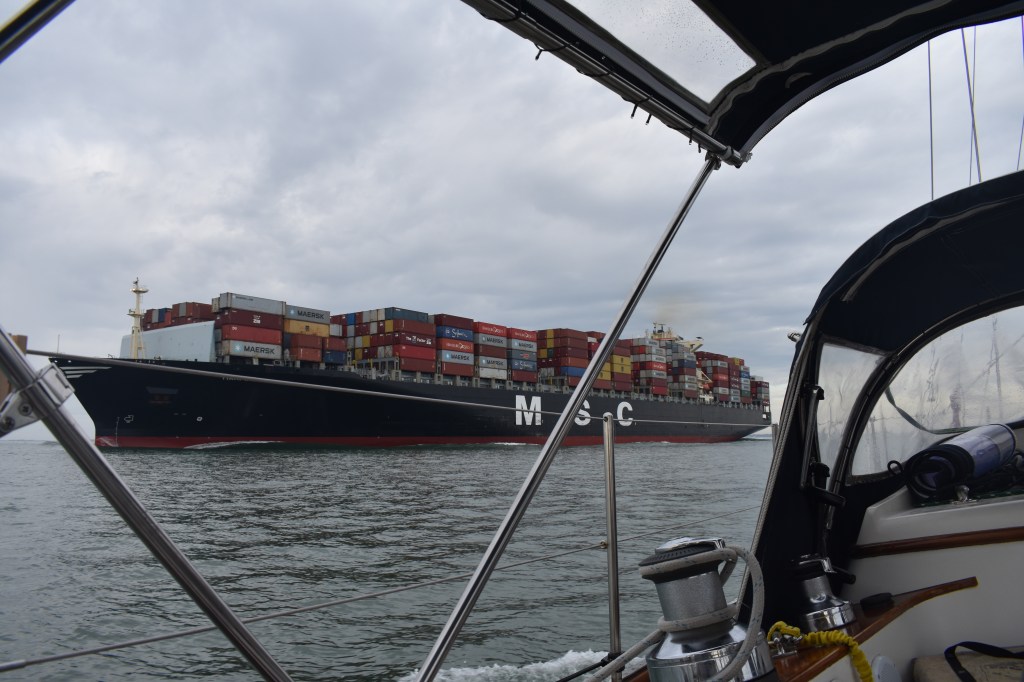
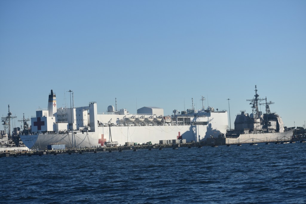
At 853 ft this was the largest tanker we’ve encountered so far. We passed by each other directly above the Hampton Roads Bridge-Tunnel (I-64). Neither of us needed to worry about our draft — the roadway is apparently 108 ft below sea level. Not the best image quality but I believe the number on the tower is 75 — which the Google says is the Nimitz-class Harry S Truman.In my Navy I wouldn’t keep the helpy ships right next to the hurty ships. But I guess we need both. That’s the Comfort, one of the hospital ships mobilized early in the pandemic.Maersk!And of course, coal. As long as people keep buying it by the shipload we’ll have to deal with the consequences to both the climate system and the Senate.
The Atlantic Intracoastal Waterway (ICW) officially begins at red buoy 36 on the Elizabeth River in downtown Norfolk. For whatever reason the Army Corps of Engineers designated that particular spot as Mile Zero on the 1000+ mile ICW. That was our general destination — but we actually ended up anchored right next to it.
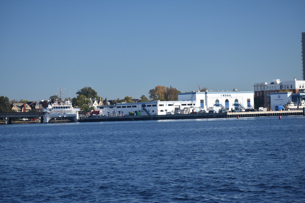
We dropped the hook in Hospital Cove, adjacent to a gigantic Naval hospital and right across the river from the NOAA lab, the maritime museum and the waterfront hotels of downtown Norfolk. And off in the distance we got the first glimpse of the busy shipbuilding industry that we will sail through tomorrow.
Mile Zero on the Atlantic ICW: Red 36 on the Elizabeth River, Norfolk.Naval Medical Center Portsmouth, formerly Norfolk Naval Hospital, is the Navy’s oldest. This is just one corner of the giant campus.NOAA lab directly across the river from our anchorageTomorrow we head further up the river right through the heart of the naval shipbuilding industry. I’m not sure why these ships are wrapped in plastic. Perhaps they are brand new and still in their bubble wrap. Or maybe they are a Christmas gift.
I spent the rest of Monday reviewing navigation tips for the ICW and researching potential overnight stops. And then I got some sleep.