It took four more days to transit the ICW to Andante’s winter home in North Carolina. The remaining 170 miles were both long and short. We put in one more very long day running from the Pungo Ferry Bridge to the head of the Alligator River, arriving at our anchorage after dark. The day included a treat in our transit through Albemarle Sound, where we could unfurl the sails again and give Andante a bit more room to roam. While we weren’t keen on running the ICW at night, it was less daunting here since Dave had visited the same anchorage several years prior and was confident in the available space, depth and holding. Nonetheless, we were very thankful for our radar, which guided us safely past several unlighted marks after dark, and for our charting program, which led us directly to Dave’s previous anchorage. In fact, we dropped the anchor almost exactly where Andante had been two years prior!
The long days allowed us to plan for a few shorter hops in the final days of our trip. The first would take us through one of the longest straight land cuts in the Pungo River – Alligator River Canal. Along this very narrow straight section of ICW, we enjoyed ever-warming temperatures, watched a bald eagle flying overhead and spotted great herons keeping watch along the shoreline. The shorter days underway were made even more enjoyable as we unfurled our sails one last time while transiting the Pamlico and Neuse Rivers.
With extra daylight hours on anchor we started working through a long list of jobs to get the boat ready for our arrival and final haul-out. Before we knew it, we were tying off lines at the dock on Core Creek, looking forward to standing on land again and greeting my parents. But we were also sad. Sad to have this great adventure behind us and sad to watch the cohort of boats we had traveled with continue south to their own destinations.
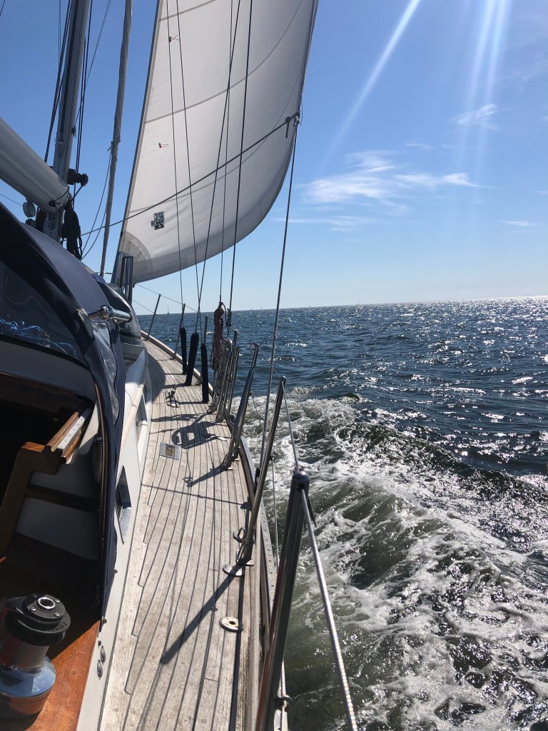
Sunset on anchor in Bellhaven, NCSailing in the Neuse River. The mainsail is stowed because we had hauled the dinghy onto deck for the final haul-out. Last few miles with canvas stowed and dock lines readyArrived!And out.
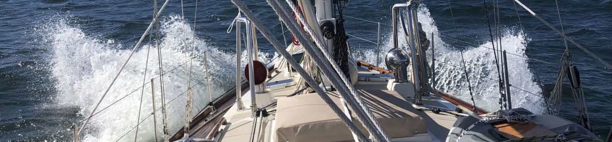
The next phase of our trip would be very different than the first, where we transitioned from sailing in wide open waters to “driving” along miles and miles of dredged channel through some of the most remote marshland I have experienced on Andante. We entered the intracoastal waterway (ICW) at mile zero and would spend the next 200-ish miles carefully following a very narrow “ditch” through some extremely remote areas to our destination just north of Beaufort, NC. At times, it felt a bit like driving 95 south to North Carolina, requiring attentiveness in navigating other traffic in the confines of the channel, biding time waiting on bridge openings, looking out for hazards (like tugs pulling barges, free-floating logs, tree stumps and uncharted shoals) and generally staying “in our lane”. We were thankful for our autopilot, which allowed us to make small continuous corrections to our course without having a hand on the wheel, and for the bathymetric survey data provided by the Army Corps of Engineers, which warned us of areas that needed extra attention. And in case we got too comfortable at any given time, the ICW would throw us a reminder in the form of a half-sunk motorboat or an entire felled tree extending partway into the channel.
On a trip like this, you focus a lot on the weather and the state of the boat and her crew. Outside concerns, beyond getting safely from point A to point B, fall away rather quickly. In fact, time becomes somewhat irrelevant, beyond knowing how many hours until sunrise and sunset or high/low tide. Not so on the ICW. In our transit south to North Carolina, we would navigate under 14 bridges and through 1 lock. Several of these bridges and the Great Bridge Lock opened on a schedule and we encountered the majority of these in our first day in the channel, making for a very busy day. We arrived at the first low bridge at mile 5.8 around 10:50 Sunday morning, noting immediately that a small handful of sailboats were anchored just north of the bridge. Usually this bridge opens on demand, but on hailing the tender we were informed that the bridge was operating under a restricted schedule (beginning that day) and would only be opening at 8 am, noon and 6 pm. We were not the only ones caught unaware!
It’s not unusual to have to wait an hour for a bridge to open so we were prepared to motor in circles until its opening. But then I looked at my Apple watch, which was clearly paying closer attention to the outside world than we and our onboard instruments were! It told us that we had an extra hour to wait and we quickly realized we had completely forgotten to “fall back” for the end of daylight savings. There’s a lot you can’t control while cruising, so you quickly learn to make the most of ‘found time’. We joined our anchored friends and made the best of a few hours sitting still with the engine off. I took advantage of the first warm temperatures of the trip and enjoyed a shower before getting underway again!
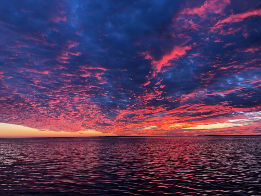
Delayed bridge openings create bottlenecks and act to group boats together for subsequent legs of their journey. We would spend the next few days on the ICW leapfrogging the same group of boats, which was oddly comforting. The options for anchoring enroute were limited and we found ourselves relying on Dave’s track from his journey south a few years prior. The first night we anchored just outside the very narrow channel north of the Pungo Ferry Bridge and enjoyed a spectacular sunset. We left all our lights on to provide visibility for anyone brave enough to travel after dark (mostly tugs with barges). The quiet was deafening and like none I have ever experienced.
Keeping track of the bridges and navigation landmarks to come in cruising guides and logs from prior trips, while keeping a close eye on our position in the “ditch”Waiting for the water to drop in Great Bridge LockShrimp boats lining the edge of the ICW
If there were a title for Leg 2 of our migration, it might be “Weather’s good. Let’s just keep going.”
We must have paid sufficient dues to the weather gods because in the days to follow we were blessed with clear skies, sunshine, calm seas and temperatures trending in the right direction. Having made the decision to head inshore to New Jersey, leg 2 of our journey would bring us south along the Jersey Shore to Cape May. With light winds on our nose, we spent the day motor sailing about 2-3 miles from shore, close enough for a nice tour of the various beach communities along our route. The cockpit on Andante can be fully-enclosed in canvas to protect us from the wind and weather which means that under bright sunshine we also stay toasty warm in our own mobile greenhouse.
Having had a good night’s sleep and with continued good weather in the forecast, we pushed south through the night guided by a near-full moon off our stern and by the very bright lights of Atlantic City off our bow. I passed the time on my night watch more comfortably this time, listening to a podcast while keeping an eye on the radar and AIS for traffic and other hazards. Sometime in the middle of my watch, I was surprised to discover a large bird peering at me over the gunwales of our dinghy hoisted in its davits on Andante’s stern. I’m not sure how long he had been resting there before I noticed him, but we would later discover that it was long enough to make a rather large mess!
We reached the southern-most tip of the Jersey Shore at Cape May just before dawn and, with light southeast winds forecast for the next few days, we pointed our bow north up the Delaware Bay. We were headed for the canal that provides passage to the upper reaches of the Chesapeake Bay. This route is extremely busy with very large commercial traffic delivering vehicles, goods and fuel to inland ports like Philadelphia and Baltimore. It took us all day to transit Delaware Bay and the Chesapeake-Delaware Canal. At twilight we entered the Chesapeake Bay and, without finding an anchorage to our liking and with the wind and weather holding, we made the decision to continue pushing south.
I started my night watch appreciating the navigational advantage gained through modern radar, charts, AIS and radio. I can’t imagine what it would be like to navigate these waters by paper chart, sight and stars alone. It is extremely difficult to determine distances over water at night and it is almost impossible to “see” your way through a meandering channel marked by lighted red and green blinking channel markers. I thanked all the technology at my disposal as a car carrier passed safely to port, only visible as a massive sky-scraper-sized absence of light and deep steady rumbling of engines. This included the AIS transponders that allow us to “see” each other in the dark, the radio that allowed us to communicate our intentions, the charts and radar that assured me that Andante was safely outside the channel and the radar that confirmed my larger friend was safely past.
The wind and currents gave us a bit of a rolling ride as we passed under the Chesapeake Bay Bridge north of Annapolis, MD around midnight, but things calmed down nicely again as the bay widened to the south and the winds dropped. We made steady progress down the length of the bay, stopping near dawn for fuel in the Patuxent River before continuing south. At this point, our goal was to reach Norfolk, VA where we would transition to daytime travel only as we entered the Intracoastal Waterway. Since Norfolk would mark the end of night watches it was perhaps fitting that we arrived around 1 am. Dave spent the night with Andante hove-to in a quiet corner of Hampton Roads while we waited for the sun to rise. Andante enjoyed the peaceful respite from transiting and was joined by a pod of playful dolphins who visited her repeatedly throughout the night.
Sunsets were uniformly spectacular
They just got better and better!Easy to spot and avoid by day! Some of the traffic in Delaware BayEasy sailing down the Chesapeake